June 01, 2017

Tracking the Royal Canadian Air Force by transponder.

Royal Canadian Air Force ensign (wikipedia)
I'm not a serious plane-spotter. I'm not a serious amateur radio guy. I'm not ex-RCAF or a Canadian Forces veteran. However, I do have an appreciation for the military and technology, and use it for my research; so I wanted to share what I know with you, as well as write it down for my own future reference.

Commercial aircraft use ADS-B transponders to identify their location to other aircraft to avoid collisions; you can read up on the technology and history here. Military aircraft, from my understanding, have ADS-B transponders, but do not use them when they are operational, since it would give away their location. Additionally, some planes seem to use some features of the transponder, but not others; so you could have a plane that is beaconing coordinates, but not altitude, for example. This is an effort to obfuscate the information from evil-do'ers.  When a plane isn't transmitting its coordinates, MLAT (essentially triangulation) is used to estimate the plane's location if enough amateur radio receivers can pick up the signal of the plane.  The likelihood of that increases as the plane increases its altitude, since it can "see" more of the earth's surface from higher altitudes (the earth is round, eh).

But how do you, sitting at home, watch these planes' transponder signals?  There are several commercial providers, businesses, that for a small monthly fee, will allow you to track commercial, and some military, planes. FightRadar24.com, PlaneFinder.net, and surely many others.  I have used them, and I do use them, but they have a small problem. They're commercial businesses, and the militaries of the world are pretty smart; they have asked these businesses, to avoid any trouble, to NOT display their aircraft. To censor their feeds, so people can't see military aircraft flying over their houses. The military does so under the guise of Operational Security, OPSEC.  I respect the idea of OPSEC, but in this case it's likely not the reason to deny the public this information, since they are emitting the signal to begin with. If the issue was truly OPSEC, they would turn the transponder completely off, as they actually do when they are conducting operations in a war-zone.  The military doesn't want you asking questions about their air movements, and censoring the data commercially available, that they are blatantly broadcasting for anyone to hear with the right equipment, ensures you don't know what they're doing, and ensures you can't stay informed.

Except... There is a crowd-sourced web site, which isn't a commercial enterprise, called ADSBExchange.com. They run on a shoestring budget, and the reporting servers are down sometimes, but overall the system works. The following links will show you reports of the Royal Canadian Air Force's planes that have been caught by people triangulating, or receiving, ADS-B signals from Canadian military planes, worldwide.

ALL RCAF 
CC-177 
CC-130H/J 
CC-150 
CC-144 
CP-140 
CC-142 
CH-147

It seems these queries will only work when the system isn't under a lot of load. I find that early in the morning I have a better chance for these reports to work.

May 31, 2017

On April 27th 2017 the Russian Navy Moma-Class AGI Liman|Лиман had a really bad day.

Photo Credit: Alper Böler‏ @alperboler
October 21, 2016
FACTS:
On April 27th the Togo-flagged livestock vessel "Youzarsif H" (also referred to as "Youzar Sif.H"), IMO 7611547, and the Russian Navy Moma-Class AGI Liman|Лиман collided, between 08:30Z and 08:43Z, in thick fog, outside Turkish territorial waters, in the Black Sea. A breach below the water line caused the Liman to sink, reportedly after several hours. All crew were rescued in an orderly fashion from the pictures that were released by the Turkish coast guard. It was reported that the Youzarsif H headed back to port to check for damage and out of concern for the livestock; sheep.

Pretty much everything beyond that is speculation.

You should really read this excellent in-depth analysis by Tony Roper, a frequent contributor to IHS Jane's publications, before reading further, to get up to speed.
https://planesandstuff.wordpress.com/2017/05/29/full-analysis-of-the-sinking-of-liman/

Sharing speculation; refuting, proving, discussing, and arguing points, makes for very good banter on Twitter, Reddit, or any social media platform where you can get people with different views together and crowd-source information and experience. I'm not sure if that friendly banter and respectful exchange of ideas was lost on Mr Roper, but for professing to not be an "Expert", he sure does seem to condescend when he portrays those who would speculate about the ships' purpose, and circumstances of it's demise, as idiots, conspiracy theorists, stupid, ignorant, and stubborn. Well,

SPECULATION & UNANSWERED QUESTIONS: 
  • Any ship could have an accident while at sea, in the fog, early in the morning. But, this wasn't "any" ship; just by being a Russian Navy AGI (a "Spy Ship") it makes me +1 suspicious. There is no good rational basis for that suspicion, except it's a Russian Navy AGI, it definitely has sensitive gear aboard, and having it sink leaves a gap in whatever task it was doing, on the deployment it was on.
    This is a seemingly inadvertent win for NATO, and a loss for the Russian Black Sea Fleet.
  • There have been no reports regarding who ran into who; or if it was a mutual effort. The news media is making it sound like they were both moving and collided in the fog. I'm not sure that's correct.
    Was this a "T-Bone" collision while both were moving?
    Was this a T-Bone collision, while the Liman was stationary?
    Was this a glancing bow-on-bow strike?
    We know the Youzarsif H was moving at 11kn before the collision, and suffered superficial damage to its bow, but we don't know if the Liman was stationary or not, since it conducts its operations without using an AIS transponder.
  • While the Liman does not transmit its location with an AIS transponder, can it receive AIS?
    Could it not "see" the other ship coming?
    AIS-T uses VHF marine frequencies
    87B (161.975 MHz)
    88B (162.025 MHz)
    Could these frequencies have been "jammed" intentionally, or accidentally?
    Likely not; any disruption to those frequencies should have affected all VHF maritime communications in the area. No such issues were reported, and most ships were beaconing fine on AIS.
  • The Liman was not a "stealth" ship, and as far as I understand, should have shown up on the navigational radar of the Youzarsif H; isn't that why navigational radar exists?
    How didn't the captain or navigator of the Youzarsif H see it?
    ...or did they, and dismissed it as noise because it didn't transmit AIS?
    Shouldn't there be a collision alarm built into the system?
    They were in thick fog, only navigating by instruments, and didn't see a ship directly in front of them on radar?
    Isn't that weird?
    I don't think it reflects well on the Youzarsif H's crew, unless the operations of the Liman were causing issues for the radar of the Youzarsif H. Yes, that's wild speculation, because it makes no sense how a ship doesn't notice a giant hulk of floating steel in front of it on radar. Make up your own crazy theory! It's better than what we have now, which is nothing.
  • The Youzarsif H's AIS signal was being received by terrestrial based AIS receivers, which Mr Roper described in his blog post with excruciating detail. The signal was very spotty before the collision, and crystal clear after the collision. This is the thing that really draws my eye and triggers my curiosity; it is the basis for much of my suspicion regarding this event. On the day Mr. Roper and I were discussing this he specifically dismissed my speculation that the issue could be related to the sender and insisted the gap in reception must be related to the receiver, or environmental conditions.
    "This totally depends on the receiver not the sender! The receiver may have been off."
    -Tony Roper, 6:29 PM EST, May 4 2017

    I tried to convey that my interest was less with the gap before the collision, and more with the immediate change to the signal quality (seemingly crystal clear reception) instantaneously after the collision, which Mr Roper had no explanation for at the time. It seems after reflection, he now theorizes the sender, may have had their antenna(s) facing away (blocked by the ship's superstructure?) from the shore-based receiver when travelling Southbound (toward the Liman) and immediately after the collision turned around and faced their AIS antenna(s) toward the shore-based AIS-T receiver. This is fantastic speculation, and would explain how the signal went from terrible, to perfect, immediately, while other ships in the area had AIS-T signal all along.
    Can we prove this theory with the available data? Well, it's certainly not as clear as I would like it to be. It is still crystal clear that immediately after the collision the AIS transmissions went from random times between successful transmissions to a steady stream at 3-4 minutes. (please refer to the spreadsheet snippet below)

    DateReceiverSpeedLongitudeLatitudeCourseDelta
    2017-04-27 06:55 (UTC)Terr-AIS11.441.8230828.98331177
    2017-04-27 07:02 (UTC)Terr-AIS11.441.7988128.984571770:07
    2017-04-27 07:05 (UTC)Terr-AIS11.341.7893528.984861780:03
    2017-04-27 07:26 (UTC)Terr-AIS11.241.7242328.984521820:21
    2017-04-27 08:20 (UTC)Terr-AIS11.141.5529528.974521850:54
    2017-04-27 08:22 (UTC)Terr-AIS11.141.5529528.974521850:02
    2017-04-27 08:30 (UTC)Terr-AIS1141.5276928.968051940:08
    2017-04-27 08:41 (UTC)Terr-AIS9.541.4994528.959211940:11
    2017-04-27 08:44 (UTC)Terr-AIS0.741.4973128.958231990:03
    2017-04-27 08:48 (UTC)Terr-AIS0.241.4969628.957552530:04
    2017-04-27 08:51 (UTC)Terr-AIS0.541.4968928.957322410:03
    2017-04-27 08:55 (UTC)Terr-AIS0.741.4965428.956732280:04
    2017-04-27 08:59 (UTC)Terr-AIS0.741.4968528.95632190:04
    2017-04-27 09:02 (UTC)Terr-AIS0.941.4971828.95667450:03
  • When did the collision occur?
    At 08:30Z, as you can see, the Youzarsif H was moving at 11kn on a course of 194 degrees.
    At 08:41Z, 11 minutes later, it was doing 9.5kn, still on the exact same course of 194 degrees. Could they have hit the ship, and shoved it aside, keeping the exact same course? I don't think so. They had significantly reduced speed by then; did they see the Liman coming and reduce speed, or were they in the middle of colliding with it at that moment?
    At 08:44Z, only 3 minutes later, they had dropped to 0.7kn and changed course to 199 degrees; the collision had already happened.
    I suspect the collision happened between 08:41 and 08:44, based on the course and speed.
    You'll notice the AIS-T problems cleared up at that exact moment too; they were at 3-4min intervals from then on.

    ¯\_(ツ)_/¯


The left hand line of dots (and gaps) are the locations where the AIS-T signal from the Youzarsif H was received by a shore-based receiver while headed South, the right hand line of dots represents the return trip where AIS was crystal clear. You might notice there was a spot where it turned around and didn't seem to have any problem transmitting it's position too. Proof of anything? Not really. (data courtesy of MarineTraffic.com)

Photo Credit: Yörük Işık‏ @YorukIsik
October 21, 2016


There is supposed to be an investigation underway by the Turkish authorities regarding this incident, and I look forward to hear what their conclusions are.

May 19, 2017

Russian Observation flights over the United States, again. (May 18-19 2017)

T-154M-LK1 RF-85655
I've written a lot about the Open Skies Treaty (here), and this week the Russian Federation Open Skies Treaty certified Tu-154M is once again in the skies over the United States.  There has been less media coverage this time, perhaps because the media didn't realize these flights normally happen once every month or two, and over cycled just weeks ago.  In short, 34 nations are signatory to the treaty, that lets the signatories overfly each others territory, with short notice, and members of the overflown nation's military on board, to take 30cm resolution pictures of sites of interest.  30cm is the defined maximum image resolution, and was the same when the Russian's used wet film.  The rest of the countries still use wet film, so far. This time, the Russians flew into Travis AFB on the West Coast, after stops for fuel in Iceland and Canada, and started observation flights Thursday March 18th 2017.  The flight plan would have been tabled either late Monday or early Tuesday, and a memo to all US Military (and related to military) sites that were going to be overflown would have been sent to ensure all unicorns were in their stables, and all stolen alien technology was back underground at Area 51, or, you know, whatever.

Here is a quick and dirty map of the locations they overflew. Why? Well, think of it this way. The sites that the RuAF are taking pictures of have been requested by the Russian Intelligence Community.  Something at these sites is interesting to someone, likely in the Russian defence industry.  But don't they have Google Maps?  Yes, but Google Maps / Bing / Nokia are all routinely tampered with by "Agencies", and the services are happy to do so to keep on governments' good sides. Entire airports can be removed and farms photo-shopped in. Buildings are over-exposed to blot out what's on top. Facilities are entirely pixelated.  Imagery is overtly tampered with, shadows moved, objects cloned. What you see on Google Maps is what the government is allowing you to see; Russia knows that.  While 30cm resolution isn't the greatest commercially available, it is good enough to show tanks loaded on rail cars, new buildings that have cropped up out of nowhere, etc.. They know their camera, and the pictures it takes, have not been tampered with.

Using its new-last-year Digital Electro Optical sensor, the flight has been basing itself out of Travis AFB in California, and at the end of the first day of observation flights, I believe it has taken pictures of the following locations, based on the altitude and airspeed.  Looking at the map below, and where you see a red dot, the plane was between 290-310kn, the sweet spot to take pictures.


Friday May 19th was the 2nd day of overflights and the Russians plotted a very similar route to what they flew in September of 2016.  Unfortunately, they varied their speed more than May 18th so it was a little harder to nail down exactly what they were taking pictures of.  My educated guesses are below:


With two observation flights complete, the Russians flew the first leg of their trip back to Moscow on May 20th, stopping for an overnight stay in Canada at CFB Trenton, which is a treaty approved refuelling stop.  All countries which are signatory to the Treaty on Open Skies must provide logistical support to Open Skies Treaty transit flights.

Russian Open Skies Observation Mission Over USA (April 13-14 2017)

April 13-14th 2017 the Russian Federation conducted an overflight of the United States in compliance with the Open Skies Treaty, with members of the USAF on board.

You will notice the sites along the Eastern Seaboard are all at locations where the Russian Navy AGI Viktor Leonov AGI spotted in February and March.  Coincidence? Absolutely not.  The Viktor Leonov's mission is to profile subs, investigate coastal radar, sonar, subsurface sensors, etc. The Open Skies Observation flight was more than likely to check out the same sites it was performing ELINT on, to "see" from above the interesting things it picked up while it was at least 12 nautical miles from shore.


April 22, 2017

Russian Bombers are not threatening the United States. Stop the madness.

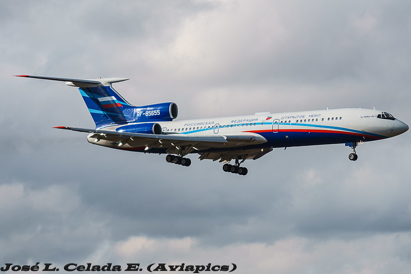
Russian Air Force Tu-95 Bear (unknown variant)
Photo Credit: Unknown
Since Donald J Trump won the American election there has been a suspicion that he did so with the help of, and in collusion with, the Russian government.  There has been a concerted information operation by a group opposed to his presidency to overthrow him by all means necessary with an unknown amount of support from within the government (also referred to as "The Deep State").  Part of the psychological operations (psyops) that this group is using to influence public opinion, and depose Donald Trump, seem to involve keeping their base paranoid and afraid; fear of anything Russian specifically. This didn't start with Donald Trump's presidency, it was already underway throughout the election campaign of Hillary Clinton.  The narrative changes over time, as facts change, but essentially Donald Trump is alleged to be some sort of puppet to Vladimir Putin, Putin has blackmail-able info on Trump, Russia has taken over the US with a bloodless coup, all decisions of the White House are somehow related to Putin, anyone opposed to this view is an agent of the Kremlin, supporting a revolution in the Democratic Party led by progressives like Bernie Sanders is juvenile and subversive, anything related to Russia is related to the election no matter how far removed, and anything that goes wrong in America, or the world, is Russia's fault.

I don't think I've even covered the half of it, but you hopefully get the idea that I'm thoroughly sick of people distorting facts regarding military deployments for political reasons and relating everything back to The Orange Menace.

DO YOU MEAN YOU DON'T BELIEVE PUTIN HELPED TRUMP? KREMLIN TROLL!

I want those people to STFU and impeach Donald Trump and stop filling Twitter with useless bullshit about how he's about to be deposed next week, two days from now, any day now, oh yes, there are papers being filed, next week, they have proof, just a couple more days, there's a dossier, there's a tape, there's evidence, there are people that said he said they said...
SHUT THE FUCK UP AND IMPEACH HIM ALREADY.
</rant>

The impact of this paranoid insistence that everything is related to Russia is poisoning the news media and having a significant influence on peoples' view of the world. Military operations that are routine and unrelated are now malicious and suspicious.

There were Russian Air Force planes in international airspace off Alaska on Monday, Tuesday, Wednesday and Thursday last week, with reports containing varying levels of detail, with varying levels of reliability, published by all the major, and not so major, news outlets.

WHY ARE YOU SO SKEPTICAL?! KREMLIN TROLL! KREMLIN TROLL!

NORAD has not been forthright in publishing information about incursions by Russian Air Force planes into the American Defense Identification Zone (ADIZ) ever; in fact, they hardly ever do, but NORAD will tell you a year or two later how many times Russian planes were in the ADIZ previous years.  Let me repeat that because it doesn't make sense.
Russians routinely fly in the ADIZ, and NORAD regularly sends interceptors, or not, depending on their assessment of the situation, but NORAD doesn't usually tell the public about it.  I presume because it's not going to affect anyone's day and they don't want the media to put their political spin on routine military operations.  Well guess what? The media has the story now and it's a gong show of armchair analysis and all the usual varied political actors and pundits have piled on. Oh joy, let the speculation run wild with very few facts.

BUT RUSSIA IS SENDING A MESSAGE TO TRUMP THAT...

No, they're not. The message is the public are totally unaware of what's going on if they can't witness the event. No civilians witnessed the event, and therefore cannot give an independent view of the events. All the information about these Russian flights comes from the American Military, Canadian Military, or NORAD public affairs. They control the message, and their message cannot be fact-checked further than what is admitted to, and what the Russians admit to; when there are disagreements it is seen as unpatriotic to question western sources. Independent confirmation doesn't exist.  I'm not saying there weren't planes off the coast of Alaska, I'm pointing out you can't fact-check any of the information provided.  My biggest issue is the news media, the journalists, add a layer of distrust to the facts.  A reporter stated the planes Tuesday were the Tu-95H variety.  While interesting, it's also incorrect; they meant the "Bear H" which is a Tu-95MS. Close, but not quite correct.  Details like this make a difference, especially regarding range, capability, age, where they're based, etc.  and since NORAD isn't issuing press releases, we have to trust the media transcribed the information correctly, which isn't always the case.
I would really prefer NORAD issued statements after every incursion into the ADIZ full of all the information we would ever want, but I know that would be a lot of work for them, so I'm not expecting anything to change.

TRUMP HASN'T SAID ANYTHING - PROOF HE'S PUTIN'S PUPPET!

The constant demand for Trump to make public statements about anything is horrendously disingenuous and incredibly stupid.  Stop asking that he open his yap for anything more than eating and drinking.  Every time he makes a statement he risks an international incident or tanking the stock market.

BUT RUSSIAN BOMBERS ARE FLYING OVER ALASKA!

By Federal Aviation Administration
Public Domain
No, they're not.  Russian planes, some of them "bombers" (but with little detail to fact-check this), flew in international airspace within an area that the American Defense Identification Zone (ADIZ). It's the area where, by the time a plane is flying towards the US, the military wants to get up in the air and figure out what's going on, if it's unexpected. The Russians doing this type of flight is routine, as in, it is performed a dozen times a year, but NORAD doesn't announce them, or retroactively when they were conducted.  If a dozen flights happened, one might assume they were spread out to have one every month. But NORAD didn't make that sort of a statement, and wouldn't nail down (they were asked by a journalist) when these approaches happened.  They always quote the yearly number, never a monthly number, which supports the idea that there are seasons to the training, ebb and flow.  What if every spring there is a flurry of air activity off Alaska?  What if that last increase in action was last spring, and NORAD didn't mention it to anyone because of the election cycle?
Oh, you want proof of that? Here you go:
"The incident was the first Russian bomber incursion of a U.S. or Canadian air defense zone this year. Officials said it likely signals the start of Russia’s long-range aviation spring training cycle. Further aerial incursions are expected." Bill Gertz, May 1, 2015
http://freebeacon.com/national-security/russia-conducts-nuclear-bomber-flight-near-alaska/
Notice when it was published? MAY 2015.
It's now the end of APRIL 2017.
The timing of last week's incidents supports the idea this is a normal yearly seasonal training cycle, AND NOT RELATED TO DONALD TRUMP.

THE LAST TIME BOMBERS FLEW NEAR THE COAST WAS JULY 4TH 2015!

By Department of Defense - Printed publication
IFR Supplement - United States., Public Domain
Bullshit. If this has any truth to it, it's playing word games off the different ADIZ zones; the Alaska ADIZ is not the same as the West Coast ADIZ, and in July 2015 the bombers said Hello off the California coast.  Maybe it is rare for the flights to be off California? So it's true, but in context trying to give the impression these most recent incursions into the ADIZ are abnormal, when they aren't? I don't know where the idea came from, it's not unusual for the planes to be in the ADIZ.

"Alaska's ADIZ averages about 10 incursions by Russian aircraft a year. The number is "growing slightly," according to Alaska NORAD officials, who characterized the Russian flights as non-provocative training missions." -Alaska Daily News, March 3rd, 2014
https://www.adn.com/military/article/russian-military-increasing-capabilities-overflights-near-alaska-airspace/2015/03/14/


TBD

I'll add more later, this is just a stub.