Showing posts with label RUaF. Show all posts

February 06, 2019

2019-01-26: NORAD intercepted two RuAF long range aviation Tu-160 bombers over the Arctic.

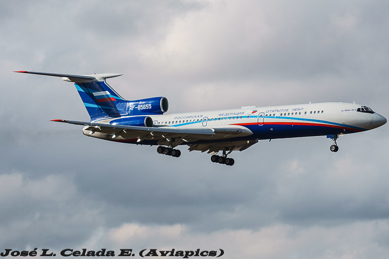
Two Tu-160 "Blackjacks" Photo Credit: Unknown
(2019-02-08 edit added at the bottom)
On January 26th 2019 Russian Air Force Tu-160 bombers took a spin around the Arctic and drew out a welcoming party of two F-22s and two CF-188s; NORAD announced the incursion into their self-assigned "Air Defence Identification Zone" or ADIZ for short. The ADIZ is international airspace, but serves as a buffer where unidentified or suspect planes are intercepted, to make sure they don't get too close to Canada or the United States in case they have hostile intentions. While too close is subjective and the ADIZ arbitrary, potential hostile aircraft should be intercepted before they are within sovereign airspace, which only extends 12 nautical miles out to sea.

These intercepts happen routinely, anywhere from none, to fifteen times in a year
(per official NORAD numbers between 2007 and 2016 (incl.))

Here is NORAD's initial tweet from Saturday January 26th, 2019:

Subsequently, on Monday, January 28th 2019, NORAD issued this longer statement:
An E-3 Airborne Early Warning and Control System, two F-22 and two CF-18 fighter jets from the North American Aerospace Defense Command positively identified two Russian Tu-160 Blackjack strategic bombers entering the Canadian Air Defense Identification Zone on January 26, 2019.
NORAD employs a layered defense network of radars, satellites, and fighter aircraft to identify aircraft and determine the appropriate response. The identification and monitoring of aircraft entering a US or Canadian ADIZ demonstrates how NORAD executes its aerospace warning and aerospace control missions for the United States and Canada.
“NORAD’s top priority is defending Canada and the United States. Our ability to protect our nations starts with successfully detecting, tracking, and positively identifying aircraft of interest approaching U.S. and Canadian airspace,” said General Terrence J. O’Shaughnessy, the NORAD Commander. “NORAD is on alert 24 hours a day, seven days a week, 365 days a year.”
Operation NOBLE EAGLE is the name given to the military response to the terrorist attacks of September 11, 2001, and applies to all air sovereignty and air defense missions in North America. NORAD is a binational command focused on the defense of both the U.S. and Canada, the response to potential aerospace threats does not distinguish between the two nations, and draws on forces from both countries. -NORAD Public Affairs (source)

FACTS


Here is a summary of the facts, derived from the original text displayed above, which you won't see on Fox, VOA, or Axios. These are the facts conveyed by NORAD themselves. Anything beyond the above details you just read came from somewhere other than two public official NORAD statements; one Saturday (Twitter), and one Monday posted to the NORAD web site. Did the journalists speak with NORAD? Did they say so? Did they cite their source? If not, they may have made it up, or maybe their editor made it up. Call them out for it.
  • The Russian planes were in the ADIZ
  • (at least) 5 NORAD planes were involved
    • 2x USAF F-22 Raptors 
    • 2x RCAF CF-188 Hornets, and 
    • 1x E-3 Sentry (aka AWACS)
  • 2 RuAF planes were "Positively identified" by NORAD; which suggests they intercepted, then flew alongside the RuAF Tu-160s, which were always in international airspace, for a period of time, until they were satisfied they were not a threat. However, I'm extrapolating my understanding from what little they said.

To Recap:
  • 2 RuAF Tu-160s were "positively identified" in the ADIZ by 4 NORAD fighters.
That is the whole story.

SPECULATION

  • Additional USAF refuelling aircraft were likely providing gas to NORAD thirsty travellers, but that is unconfirmed. 
  • It is unlikely all four planes were escorting the Tu-160s the entire time. There would likely have been a "hand off" from one pair to the other at some point.

FALSEHOODS

  • "Russian bombers buzz North American coastline" was coined by Lucas Tomlinson (@LucasFoxNews) and Fox News producers. I can't say that a NORAD person never said those words to Lucas and his editor/producer, nor does Lucas claim they did, or quote them - someone editorialized what NORAD said. However, the statement is unlike anything I've ever heard from anyone at NORAD I've ever spoken to. "Buzzed" would imply proximity to the shore or "coast". NORAD's statement specifically said they had not entered sovereign airspace, which extends 12 Nautical Miles from shore; so factually, citing NORAD, I can tell you they were not "Buzzing" the coast, and that Fox has deliberately mis-characterized the flight for the sake of sensationalist reporting; for propaganda even.
    https://www.foxnews.com/world/russian-bombers-buzz-north-american-coastline
  • Unfortunately, other media outlets and bloggers jumped on this "coast" narrative and made it the news of the day, regardless of the facts. I hope journalists and editors realize they were used by partisan politics in propagandizing the routine flight in international airspace and will be more wary next time, but have little hope that will be the case.

RUSSIAN VS NORAD STRATEGIC COMMUNICATION:


~4 hours before NORAD tweeted about the intercept, the Russian Military TV Channel "Star" broadcast the Tu-160 story, from their point of view.

Saturday
(2019-01-26 16:48 Moscow (13:48Z)
"Два стратегических ракетоносца Ту-160 выполнили плановый полет в воздушном пространстве над нейтральными водами акваторий Северного Ледовитого океана, Баренцева, Лаптевых и Карского морей.
Продолжительность полета составила более 15 часов. В ходе полета экипажи Ту-160 отработали дозаправку топливом в воздухе."
or, Google Translated...
"Two strategic missile carriers Tu-160 performed a planned flight in airspace over the neutral waters of the Arctic Ocean, the Barents, Laptev and Kara seas.
The flight duration was more than 15 hours. During the flight, the crews of the Tu-160 worked refueling in the air."
https://tvzvezda.ru/news/forces/content/201901261648-gd93.htm

2019-01-26 19:40 Moscow (16:40Z)
"Плановый полет прошел над нейтральными водами акваторий Северного Ледовитого океана, моря Лаптевых, а также Баренцева и Карского морей."
or
"The scheduled flight took place over the neutral waters of the Arctic Ocean, Laptev Sea, and the Barents and Kara Seas."
https://tvzvezda.ru/news/forces/content/201901261936-by3o.htm

2019-01-26 12:40 EST (17:40Z) NORAD releases statement via Twitter
"An E-3 AWACS, 2x F-22, 2x CF-18 fighter jets from NORAD positively identified 2x Russian Tu-160 Blackjack strategic bombers entering the Canadian Air Defense Identification Zone on January 26, 2019. Bombers remained in international airspace and did not enter sovereign territory"

2019-01-26 23:59 Moscow (20:59Z)
«Полет был для нас более обычным и привычным. 16 часов – это не максимум, который мы летали»
or
“The flight was more ordinary and familiar to us. 16 hours is not the maximum that (we've flown)” -Lieutenant Colonel Alexander Zheludkov, RuAF
https://tvzvezda.ru/news/forces/content/201901270001-dnlk.htm

Sunday
2019-01-27 03:59 Moscow (00:59Z)
"Опубликованы кадры ночной дозаправки Ту-160 над водами Арктики"
or
"(Zvezda) Published footage (of) night refueling of the Tu-160 over the waters of the Arctic"
https://tvzvezda.ru/news/forces/content/201901270401-u447.htm

2019-01-27 04:44 Moscow (01:44Z)
"Пять военных самолетов США и Канады подняли по тревоге из-за Ту-160"
or
"Five military aircraft of the United States and Canada raised the alarm because of the Tu-160"
https://tvzvezda.ru/news/vstrane_i_mire/content/201901270444-ly6v.htm

Whereas TV Zvezda is the Russian military TV network, and usually provides original Russian-sourced information, Sputnik usually mirrors what is being broadcast in the United States with an alternative view from a Russian angle (mileage may vary); take this post which could have referred to Russian sources, but instead reported on American sources in English, and added what sort of weapons loadout they could have (not what weapons they *did* have, because all indicators point to the plane being empty).

2019-01-27 11:07 Moscow (08:07Z)
US, Canadian Jets ‘Identified’ Russian Bombers in Airspace Near Canada - NORAD
https://sputniknews.com/world/201901271071857898-us-canada-tu-160/

Monday
2019-01-28 Zulu
"An E-3 Airborne Early Warning and Control System, two F-22 and two CF-18 fighter jets from the North American Aerospace Defense Command positively identified two Russian Tu-160 Blackjack strategic bombers entering the Canadian Air Defense Identification Zone on January 26, 2019."
http://www.norad.mil/Newsroom/Press-Releases/Article/1741730/norad-identified-russian-aircraft-entering-canadian-air-defense-identification/


I think it's quite possible they intentionally schedule the flight when they expected the least response from NORAD Public Affairs and he public; my impression is these get more coverage on weekdays rather than weekends. I could be wrong.

WHAT? NO MAP?

Unfortunately, unlike the Japanese Maritime Self-Defense Forces who post a summary of Russian air movements in their air-defence zone, NORAD does not give us any context where the flights took place. This obfuscation is said to be for "Operational Security" reasons, but I don't quite understand that, since we're referring to Russian planes who know they were intercepted.

Japanese Joint Chiefs of Staff Press Release (via Twitter) including map of Russian operations near Japan; you've never seen anything like this issued by NORAD because they've never done so.


I can't see why NORAD would seem to feel releasing the above Japanese-style map would compromise national security, but it would greatly improve the understanding of NORAD operations for the public at large, and neuter any attempts at disinformation efforts that would portray the event as something more than it was.

FINE, HERE'S AN UGLY MAP

This is a screenshot of OpenStreetMaps which shows you the 12 nautical mile limit as a thin purple line. Please note that between the coast of Russia, and the line; that's Russian airspace. Between the Alaskan coast and the purple line; that's American airspace. That's all of it; 12 Nautical Miles. It's not very far at all, especially by plane.

Here we have an FAA-data driven Google Earth image showing the ADIZ. If a Russian Air Force plane flies through the green zone shown below, NORAD may send an interceptor to say Hi. They might not. The idea is to keep the Russians guessing regarding when and where they are detected by coastal radar or other national technical means. Did they, or didn't they see them flying by? You'll notice that the ADIZ is mostly over international waters, which is where you'd need to be to intercept a Russian bomber, before it unloads ALCMs at CONUS; that's the idea anyway.

Most of the time people do not see the earth from the top, and do not appreciate that Russia is just on the other side of the pole. I believe people know they are there, on the other side, but just never see what that means, like this, over the top - withe the ADIZ in green:


Exactly where the Tu-160 took off from and landed was not published, but they did say they travelled over the Arctic, Laptev, Barents, and Kara Sea - and always in international airspace; which is easy to do, since it's all international airspace past 12 nautical miles from shore.

I can hope that someone at NORAD sees my butchery of Google Earth maps / the ADIZ and demands they publish better maps so they never have to be subjected to my graphics "prowess" again.

THERE'S VIDEO?


Unfortunately Lieutenant-General Sergey Kobylash, the commander of long-range aviation of the RuAF isn't a Twitter guy, so I don't think I'll be able to ask him any specifics on the mission, but here are the videos they published of the flight (the same flight) as NORAD announced. You may not be aware, but NORAD has no obligation to Canadians or Americans to tell us every time they perform one of these interceptions; they only release the information if the Russians publish something about it, or if someone at the Pentagon leaks it to the press, forcing their hand.

As an aside; it sure would be nice to get 1080p or 4k NORAD footage, wouldn't it?


The news media routinely make the same mistakes, with clickbait headlines about intrusions into North American airspace, every single time one of these flights takes place, but NORAD every single time diligently tells the public no national airspace was crossed, and the bombers were never in sovereign airspace. Why editors and producers of the news ignore this can only be because of clicks, because it certainly isn't from being accurate. Kudos to you journalists who didn't fall for the "buzz the coast" narrative, and a finger wag to those of who who spread the story in that "Fake News" light.

2019-02-08 Update


Thank you to the mystery person (and people!) who are monitoring the Russian HF radio networks the bombers talk to each other (unencrypted, old school, voice comms) while performing operations, live tweeting it for the world to read as it happens. I completely missed this thread on Twitter, and several side-bar threads of people I follow, and who follow me on Twitter; so I profusely apologize to them for not noticing and not including the information they had put out there while the action was going on.


We knew the Russians said they were doing refuelling up over the Arctic on their 15 hour training flight, but now we know the composition of that effort.
  • 2x Tupolev Tu-160 strategic bombers (58401, 58402)
  • 1x Tu-160 strategic bombers acting as a communication relay (58403)
  • 4x Ilyushin Il-78 refuelling planes (90722, 90723, 90724, 90725)
That's a pretty impressive sortie, I'd say.

June 12, 2018

Planet Labs satellite imagery shows Yantar at RuAF Su-30 crash site in May.

After departing the Mediterranean, and making a hairpin turn within hours after the crash of the RuAF Su-30 in the waters off Syria, Russian Navy Oceanographic Research Vessel Yantar finally got back to Syrian waters, to the exact spot shown on the aforementioned image from Planet Labs where the oil sheen was seen on the water, less than 3 km from the shore of Jableh, Syria, where the RuAF Su-30 crashed.

We can see Yantar in the area on May 11th, 16th, and 17th.
AIS data shows they were in the vicinity the whole time, out of frame.

They may have been looking for the remains of the pilots, and/or retrieving initialized crypto hardware aboard the plane, which would be hugely valuable for Western intelligence agencies to collect.

Thank you Planet Labs for providing the 3m imagery!

May 04, 2018

2018-05-03: Russian Air Force (RuAF) Su-30 crash off the coast of Jablah, Syria


by: ria.ru

Image available within an hour of the accident.
On May 3rd 2018 a Russian Air Force Su-30 jet crashed shortly after take-off for unknown reasons. Initial rumours suggested a bird strike on take-off, and with a full load, a loss of an engine would have been catastrophic. So where did it crash, exactly?

Let me introduce you to satellite imagery that isn't quite as crystal clear as the 30 cm resolution imagery you're used to on Google Maps. 3 meter resolution imagery is updated much more frequently, allowing the kind of coverage you simply couldn't find commercially in the past. Enter Planet Labs, and here is their image from 2018-05-03 at 10:47am local time. The crash is reported to have happened within a half hour previous to the picture. In the image we see what looks to be small boats, a small oil sheen, and possibly debris ~3 km from shore.

I'm not getting into the geopolitical aspects of the Syrian war, if the Russian air force should be there, or commenting on the loss of the two Russian pilots (which is a tragedy regardless of who's side you're on); I'm just using this as an example of how readily available satellite imagery can spot a crash site and give you information about something very quickly after such an event, before the news media has caught up on the story, or even officials are aware of what's going on. Never before have the public been able to short-circuit the dissemination of information to this extent, and bypass traditional media. I don't mean that journalism is dead, I think journalists are able to take a step back and do the deeper dive, and get more information to publish the "whole" story, while people get their fix for immediate news from primary sources like never before.


October 03, 2017

Open Skies Treaty overflight of the United States by the RuAF Sept 25-29 2017

From September 25th to 29th the USAF played host to an Open Skies Treaty overflight of the United States by the Russian Federation.  Here is the flight plan as captured by FlightRadar24, as best as it was able to track the flight using Mode-S MLAT, triangulating transponder information received by private receivers across the country. You'll notice the green dots are likely sites which pictures were being taken, as they were within the allowable envelope. Provided they were at ~11,000ft, and not banking, they would be allowed take pictures, per the treaty and arranged flight plan.

Flying at 11,000ft indicates the digital electro-optical sensor (that when spoken of before the Senate Armed Services Committee was made to sound like the Death Star by DIA 3-Star General Stewart) was in "medium" altitude mode, and the swath was 7.7km (4.8mi) total width.  Please remember that USAF members are aboard the plane for the entire overflight, the camera being used has been certified by a 22 nation committee, and the resolution of the imagery is worse than commercially available satellite imagery.

As usual, the USAF did not inform the American people of this overflight because their media posture is "passive", by policy. Only the Russian news media, usually maligned as "fake news" or propagandists, inform us of these flights. Why would the US Government be more controlling with the message than the Russians? Wouldn't they want to show a working treaty in action and dispel any fear about the Red Scare narrative? 🤔

(There is another Open Skies overflight going on this week, FYI)

August 17, 2017

Two Russian Open Skies Treaty aerial observation missions over the USA in June 2017

If you're unfamiliar with the Open Skies Treaty, I've written quite a bit about it before, and I highly recommend leafing through the old blog posts to get up to speed.

What you're about to read is coverage that no news organisation (that I'm aware of) is providing you, because USAF policy is to not talk about Open Skies Treaty observation flights.  Yes, like Fight Club. Since no press releases are put out by the USAF, no US media cover the flights, because they don't know what to say, and all the USAF personnel who could say something, are not allowed to per USAF policy.  Page 30, Section 4.2.1.1.4.7, Air Force Manual 16-604 (2009) "posture for OST flights is “passive.” (we) respond to inquiries, but (don't) promote activities" while that does not specifically state that USAF personnel are not allowed to talk about it, the information is classified (a low-level classification) and the treaty is obscure.  If the US Media were trying to confirm when a flight was happening, IF it was happening, their first source would be TASS or Sputnik, which would immediately raise red flags to Western Media editors. After all, why believe these agents of disinformation and Russian propaganda?  Well, maybe because they're the only people who publicise the treaty overflights; of the US over Russia, or Russia over other countries.  Why is it that only Russia tells their people about a 34+ nation treaty that's working extremely well? Why doesn't the US government want their citizens to know they exercise their treaty rights to overfly Russia, and Russia does the same to the USA, on an almost monthly basis?

I don't know. It's a complete mystery to me.

The Russian Federation performed two scheduled aerial observation missions over the United States under the terms agreed upon by the 34-35 nations in the Treaty on Open Skies, or Open Skies Treaty as it is commonly referred to, between June 19th and June 30th, 2017. Per treaty rules, they left, stopped at CFB Trenton, and went back in between overflights.

June 19 - June 23, 2017

The Russian team flew in to Travis AFB, on their Treaty-approved Tupolev Tu-154M, and recently outfitted digital camera, from Moscow, on Monday, and likely negotiated the flight plan they proposed on Tuesday morning with the American team. The US team is assigned to escort them in their observation plane and ensure all restrictions of the overflight are adhered to; heights are as promised, courses are adhered to, etc. From Tuesday to Thursday (Thursday is when the observation flights started) the US military and defence industry would have been alerted, and would likely have been covering up/moving any equipment they did not want photographed that was along the flight path.  This is standard procedure, and known to be a cat and mouse game.  Anything too big to move will simply be photographed, but these flights, while short notice, can be anticipated to a certain extent. They are routine, happen half a dozen times a year, and I don't think any out-in-the-open testing is ever performed without consideration regarding it being photographed by satellites or the Open Skies Treaty overflights.  After all, the Russian Federation (and the Chinese) also have satellites which can (at least) see the visual spectrum, and may also be outfitted with space-borne Synthetic Aperture Radar. After a brief tour of California, the Russian team (with their American handlers aboard) went to Alaska.  Unfortunately, FlightRadar24 and ADSBExchange have terrible coverage up there, and little of the flight was captured by transponder.  From what I gather that may or may not have overflown several air force bases including missile launch facilities.


June 26 - June 30, 2017

The second week's flights took place first over Texas at a low altitude (5000ft), then after a brief stop to uncover the belly mounted framing camera, continued at a higher altitude. On Friday they finished off the New Mexico leg of the trip, overflying many famous historical nuclear test, development, and production facilities.


But what did they take pictures of?  Well, that's an excellent question. I don't know, but I can make some educated guesses, and you can too,  if you follow along:

  • Open Skies Treaty flights are based on a negotiation of a flight plan that is proposed by the overflying party. The observed party can argue or debate which route to the locations might be best, if poor weather is expected, or if cloud cover will hamper the trip, they can propose alternate routes or sites. Ultimately, the overflying party can refuse the options and insist on the flight plan they want, and if the overflown party objects, they need to cancel the whole trip, with causses a major international incident.  But, there are some things that are constant on these flight plans (from studying past flight plans); steady speed and constant height are tell-tale signs of photos being taken. When the flight plan is agreed to, there are legs, and for each leg an altitude is selected which will place the camera at the correct distance from the ground to get 30cm imagery.  Same with speed; they want the speed of the aircraft to be consistant. Usually the height is between 8000-12000ft and the speed between 300-350kts.  On the maps I've marked potential sites in the right speed envelope in green (based on my best estimate). If the plane is doing 500kts, they aren't taking pictures. If they're at 34,000ft, they aren't taking pictures either. If they're at 8,000ft, and doing 300kts, you can bet they're taking pictures, or are lining up for the shot.
  • American military or defence installations are sometimes pretty easy to spot along the line, especially if they're extremely remote.  If in the middle of a desert there's a runway, some fiel tanks, and some buildings... congratulations you've found some semi-secret remote military industrial complex test site, or where they keep the aliens; you get the idea.  If the speed of the plane is between 300-350, and the height is stable, that's the sweet spot, and you know there is either something there, something was there previously, or they thought something could be there, and wanted a closer look.
  • Open Street Maps makes it easy to spot government facilities, as they're usually large pink sections of the map. Have a look at https://www.openstreetmap.org/ if you're struggling to name a site, and you might find it spelled out to you.
This is an Open Skies (OS) Format 14 document, submitted to the Canadian RCAF by the Russian RuAF at the conclusion of one of their Open Skies Treaty flights over Canada.


As I've pointed out previously, there is absolutely no reason any American reading this couldn't request (via FOIA) from the USAF, State Department, or DTRA, ALL the flight plans documented on Open Skies Format 14 templates (like the above) from 2002 to present day.
That will tell you exactly what legs were flown, and where the pictures were taken.

So what are you waiting for?

May 19, 2017

Russian Observation flights over the United States, again. (May 18-19 2017)

T-154M-LK1 RF-85655
I've written a lot about the Open Skies Treaty (here), and this week the Russian Federation Open Skies Treaty certified Tu-154M is once again in the skies over the United States.  There has been less media coverage this time, perhaps because the media didn't realize these flights normally happen once every month or two, and over cycled just weeks ago.  In short, 34 nations are signatory to the treaty, that lets the signatories overfly each others territory, with short notice, and members of the overflown nation's military on board, to take 30cm resolution pictures of sites of interest.  30cm is the defined maximum image resolution, and was the same when the Russian's used wet film.  The rest of the countries still use wet film, so far. This time, the Russians flew into Travis AFB on the West Coast, after stops for fuel in Iceland and Canada, and started observation flights Thursday March 18th 2017.  The flight plan would have been tabled either late Monday or early Tuesday, and a memo to all US Military (and related to military) sites that were going to be overflown would have been sent to ensure all unicorns were in their stables, and all stolen alien technology was back underground at Area 51, or, you know, whatever.

Here is a quick and dirty map of the locations they overflew. Why? Well, think of it this way. The sites that the RuAF are taking pictures of have been requested by the Russian Intelligence Community.  Something at these sites is interesting to someone, likely in the Russian defence industry.  But don't they have Google Maps?  Yes, but Google Maps / Bing / Nokia are all routinely tampered with by "Agencies", and the services are happy to do so to keep on governments' good sides. Entire airports can be removed and farms photo-shopped in. Buildings are over-exposed to blot out what's on top. Facilities are entirely pixelated.  Imagery is overtly tampered with, shadows moved, objects cloned. What you see on Google Maps is what the government is allowing you to see; Russia knows that.  While 30cm resolution isn't the greatest commercially available, it is good enough to show tanks loaded on rail cars, new buildings that have cropped up out of nowhere, etc.. They know their camera, and the pictures it takes, have not been tampered with.

Using its new-last-year Digital Electro Optical sensor, the flight has been basing itself out of Travis AFB in California, and at the end of the first day of observation flights, I believe it has taken pictures of the following locations, based on the altitude and airspeed.  Looking at the map below, and where you see a red dot, the plane was between 290-310kn, the sweet spot to take pictures.


Friday May 19th was the 2nd day of overflights and the Russians plotted a very similar route to what they flew in September of 2016.  Unfortunately, they varied their speed more than May 18th so it was a little harder to nail down exactly what they were taking pictures of.  My educated guesses are below:


With two observation flights complete, the Russians flew the first leg of their trip back to Moscow on May 20th, stopping for an overnight stay in Canada at CFB Trenton, which is a treaty approved refuelling stop.  All countries which are signatory to the Treaty on Open Skies must provide logistical support to Open Skies Treaty transit flights.

Russian Open Skies Observation Mission Over USA (April 13-14 2017)

April 13-14th 2017 the Russian Federation conducted an overflight of the United States in compliance with the Open Skies Treaty, with members of the USAF on board.

You will notice the sites along the Eastern Seaboard are all at locations where the Russian Navy AGI Viktor Leonov AGI spotted in February and March.  Coincidence? Absolutely not.  The Viktor Leonov's mission is to profile subs, investigate coastal radar, sonar, subsurface sensors, etc. The Open Skies Observation flight was more than likely to check out the same sites it was performing ELINT on, to "see" from above the interesting things it picked up while it was at least 12 nautical miles from shore.


April 22, 2017

Russian Bombers are not threatening the United States. Stop the madness.

Russian Air Force Tu-95 Bear (unknown variant)
Photo Credit: Unknown
Since Donald J Trump won the American election there has been a suspicion that he did so with the help of, and in collusion with, the Russian government.  There has been a concerted information operation by a group opposed to his presidency to overthrow him by all means necessary with an unknown amount of support from within the government (also referred to as "The Deep State").  Part of the psychological operations (psyops) that this group is using to influence public opinion, and depose Donald Trump, seem to involve keeping their base paranoid and afraid; fear of anything Russian specifically. This didn't start with Donald Trump's presidency, it was already underway throughout the election campaign of Hillary Clinton.  The narrative changes over time, as facts change, but essentially Donald Trump is alleged to be some sort of puppet to Vladimir Putin, Putin has blackmail-able info on Trump, Russia has taken over the US with a bloodless coup, all decisions of the White House are somehow related to Putin, anyone opposed to this view is an agent of the Kremlin, supporting a revolution in the Democratic Party led by progressives like Bernie Sanders is juvenile and subversive, anything related to Russia is related to the election no matter how far removed, and anything that goes wrong in America, or the world, is Russia's fault.

I don't think I've even covered the half of it, but you hopefully get the idea that I'm thoroughly sick of people distorting facts regarding military deployments for political reasons and relating everything back to The Orange Menace.

DO YOU MEAN YOU DON'T BELIEVE PUTIN HELPED TRUMP? KREMLIN TROLL!

I want those people to STFU and impeach Donald Trump and stop filling Twitter with useless bullshit about how he's about to be deposed next week, two days from now, any day now, oh yes, there are papers being filed, next week, they have proof, just a couple more days, there's a dossier, there's a tape, there's evidence, there are people that said he said they said...
SHUT THE FUCK UP AND IMPEACH HIM ALREADY.
</rant>

The impact of this paranoid insistence that everything is related to Russia is poisoning the news media and having a significant influence on peoples' view of the world. Military operations that are routine and unrelated are now malicious and suspicious.

There were Russian Air Force planes in international airspace off Alaska on Monday, Tuesday, Wednesday and Thursday last week, with reports containing varying levels of detail, with varying levels of reliability, published by all the major, and not so major, news outlets.

WHY ARE YOU SO SKEPTICAL?! KREMLIN TROLL! KREMLIN TROLL!

NORAD has not been forthright in publishing information about incursions by Russian Air Force planes into the American Defense Identification Zone (ADIZ) ever; in fact, they hardly ever do, but NORAD will tell you a year or two later how many times Russian planes were in the ADIZ previous years.  Let me repeat that because it doesn't make sense.
Russians routinely fly in the ADIZ, and NORAD regularly sends interceptors, or not, depending on their assessment of the situation, but NORAD doesn't usually tell the public about it.  I presume because it's not going to affect anyone's day and they don't want the media to put their political spin on routine military operations.  Well guess what? The media has the story now and it's a gong show of armchair analysis and all the usual varied political actors and pundits have piled on. Oh joy, let the speculation run wild with very few facts.

BUT RUSSIA IS SENDING A MESSAGE TO TRUMP THAT...

No, they're not. The message is the public are totally unaware of what's going on if they can't witness the event. No civilians witnessed the event, and therefore cannot give an independent view of the events. All the information about these Russian flights comes from the American Military, Canadian Military, or NORAD public affairs. They control the message, and their message cannot be fact-checked further than what is admitted to, and what the Russians admit to; when there are disagreements it is seen as unpatriotic to question western sources. Independent confirmation doesn't exist.  I'm not saying there weren't planes off the coast of Alaska, I'm pointing out you can't fact-check any of the information provided.  My biggest issue is the news media, the journalists, add a layer of distrust to the facts.  A reporter stated the planes Tuesday were the Tu-95H variety.  While interesting, it's also incorrect; they meant the "Bear H" which is a Tu-95MS. Close, but not quite correct.  Details like this make a difference, especially regarding range, capability, age, where they're based, etc.  and since NORAD isn't issuing press releases, we have to trust the media transcribed the information correctly, which isn't always the case.
I would really prefer NORAD issued statements after every incursion into the ADIZ full of all the information we would ever want, but I know that would be a lot of work for them, so I'm not expecting anything to change.

TRUMP HASN'T SAID ANYTHING - PROOF HE'S PUTIN'S PUPPET!

The constant demand for Trump to make public statements about anything is horrendously disingenuous and incredibly stupid.  Stop asking that he open his yap for anything more than eating and drinking.  Every time he makes a statement he risks an international incident or tanking the stock market.

BUT RUSSIAN BOMBERS ARE FLYING OVER ALASKA!

By Federal Aviation Administration
Public Domain
No, they're not.  Russian planes, some of them "bombers" (but with little detail to fact-check this), flew in international airspace within an area that the American Defense Identification Zone (ADIZ). It's the area where, by the time a plane is flying towards the US, the military wants to get up in the air and figure out what's going on, if it's unexpected. The Russians doing this type of flight is routine, as in, it is performed a dozen times a year, but NORAD doesn't announce them, or retroactively when they were conducted.  If a dozen flights happened, one might assume they were spread out to have one every month. But NORAD didn't make that sort of a statement, and wouldn't nail down (they were asked by a journalist) when these approaches happened.  They always quote the yearly number, never a monthly number, which supports the idea that there are seasons to the training, ebb and flow.  What if every spring there is a flurry of air activity off Alaska?  What if that last increase in action was last spring, and NORAD didn't mention it to anyone because of the election cycle?
Oh, you want proof of that? Here you go:
"The incident was the first Russian bomber incursion of a U.S. or Canadian air defense zone this year. Officials said it likely signals the start of Russia’s long-range aviation spring training cycle. Further aerial incursions are expected." Bill Gertz, May 1, 2015
http://freebeacon.com/national-security/russia-conducts-nuclear-bomber-flight-near-alaska/
Notice when it was published? MAY 2015.
It's now the end of APRIL 2017.
The timing of last week's incidents supports the idea this is a normal yearly seasonal training cycle, AND NOT RELATED TO DONALD TRUMP.

THE LAST TIME BOMBERS FLEW NEAR THE COAST WAS JULY 4TH 2015!

By Department of Defense - Printed publication
IFR Supplement - United States., Public Domain
Bullshit. If this has any truth to it, it's playing word games off the different ADIZ zones; the Alaska ADIZ is not the same as the West Coast ADIZ, and in July 2015 the bombers said Hello off the California coast.  Maybe it is rare for the flights to be off California? So it's true, but in context trying to give the impression these most recent incursions into the ADIZ are abnormal, when they aren't? I don't know where the idea came from, it's not unusual for the planes to be in the ADIZ.

"Alaska's ADIZ averages about 10 incursions by Russian aircraft a year. The number is "growing slightly," according to Alaska NORAD officials, who characterized the Russian flights as non-provocative training missions." -Alaska Daily News, March 3rd, 2014
https://www.adn.com/military/article/russian-military-increasing-capabilities-overflights-near-alaska-airspace/2015/03/14/


TBD

I'll add more later, this is just a stub.


October 01, 2016

Russian Open Skies Treaty overflight of the USA | September 26th-30th 2016

Nevada Test Site - Gate 1
Taken April 2 2010 - Photo by Bill Ebbesen (Wikipedia)
While I don't intend to blog about every single Open Skies Treaty overflight of the United States of America by the Russian Air Force, Nevada is a hub of historically significant military sites, and continues to be a hotbed of military testing facilities, restricted airspace, and military bases. Generally, the Russian Air Force doesn't pick the places they photograph; they are the operators and tip of the spear;.  The RuAF execute requests by other agencies for imagery of American locations of interest, not just requests from the Russian Ministry of Defence. Since each Open Skies mission has a limited amount of distance it can cover, as mandated by the Treaty, the Russians do not try and fly over all of the US at once, they break it up into zones. This flight was an observation mission over California and Nevada. If you zoom in to a reasonable detail level and follow the flight path you'll find a "who's who" (a what's what?) of DoD and DoE locations, as well as other places of interest to the Russian Federation.  Reverse-engineering this flight path, you can discern where the US Military is conducting their most sensitive testing, training, research, and any number of other "interesting" things.

Previous Open Skies treaty posts here for background.

Thank you @ktul_adsb for spotting additional points of interest!

NB: RF-85655 just took off en route to CFB Trenton, Iceland, and ultimately Kubinka (Кубинка) Air Base, originating from Travis AFB where last week's mission was being based from.


September 18, 2016

Tracking Russian Open Skies Tu-154M / Tu-214ON Aircraft

Photo by Mark Beal (@veryboeing) during RF-85655's stop-over in Halifax, Nova Scotia on 2016-09-01
While American Open Skies flights have been using the same planes since the Treaty on Open Skies (Open Skies Treaty) came into force in 2002, the Russian Federation are phasing in a new pair of Tupolev Tu-214ON planes.  The Tupolev Tu-154M is still being used for Canadian / US / Danish overflights, and I am not sure how long it will be before the Tu-214ON takes over.

Tupolev Tu-154M/LK-1
Reg: RA-85655
C/N 89A798
ICAO 194E97 (154E97?)

Tupolev Tu-214ON
Reg: RA-64519
C/N 42709019
ICAO 14FC07

Reg: RA-64525
C/N 41003025
ICAO 14FC0D

It seems like only RA-64525 can be found on adsbexchange.com, and neither of the new planes can be found on flightradar24.com.  Hopefully they fix that soon!

September 05, 2016

Open Skies Treaty overflight; Russia over Canada 2016


Russian Federation Open Skies Plane
Tupolev Tu-154M LK1
Registration: RA-85655
Mode-S Code: 194E97
Serial Number (MSN): 89A798


Photo by Mark Beal (@veryboeing)
during RF-85655's stop-over in
Halifax, Nova Scotia on 2016-09-01


The Russian Federation held their yearly Canadian Open Skies Treaty mission this past week, arriving at CFB Trenton from Washington DC, on the heels of their previous Open Skies Treaty mission in the United States.  The Russians landed at CFB Trenton on August 27th ~1830Z, and departed for Russia on September 3rd ~1900Z.

Since the treaty came into force in 2002, states who are signatory to the Treaty on Open Skies (also known as the Open Skies Treaty) can conduct a treaty-defined maximum number of yearly overflights of other signatory nations, with a maximum flight distance dependant from where they are taking off from in that country, and only certain airports in signatory nations are approved for these observation planes to land.  Not all countries have approved planes; with approved sensors, or approved cameras.  Those that don't piggy-back on the flights of other signatory states.  The purpose of these flights is to take pictures of the other signatory members' military and industrial facilities to build confidence that the "other side" isn't amassing troops or tanks on the border, out of conventional view, or hiding from satellite imagery, but located perhaps where a closer-to-the-ground plane would be able to photograph them.  The overflights are conducted at a height and speed that allows for 30cm resolution imagery, which is slightly less detailed than publicly available commercial satellite imagery today.  There are 34 states who are party to the agreement today, including Canada, the United States, and the Russian Federation.  My previous posts about the Open Skies Treaty are here.

Several people have asked why this visit by the Russian Air Force is important, or news-worthy; this is a treaty that has been in place since 2002, and overflights happen routinely.  It's a good question with a complicated answer.  Most importantly to me; most Canadians don't know a level of cooperation exists with the Russian Federation that would allow them to overfly Canada and take pictures of anything they want, anywhere, coast to coast to coast.  Most Canadians don't know that Canada does the same over Russia, flying over their territory more than once a year, and photographing anything, anywhere.  Right now, perhaps more than ever, the rhetoric out of some factions of world governments would like to vilify the Russian or American governments as evil empires intent on world domination.  Leveraging the imagery attained from Open Skies overflights can diffuse some of those wild rumours.  Treaties like the Open Skies Treaty show that world powers can actually work together and cooperate. Treaties work when they are negotiated in good faith, and applied in good faith.  The Open Skies Treaty is, in my opinion, a poster child for successful treaties and diplomatic negotiation, despite minor issues in its application over Russian Federation territory.  Interestingly, while the treaty and overflights are not highly classified endeavours, neither the American or Canadian governments publish press releases about them when they occur, but will answer questions when asked.  Russian media (TASS, Sputnik, etc) publish the flight is going to take place right before it happens; this is true for flights over Russia, or flights being conducted by Russia over other countries.

While the Russians could visit Canada more often (per the treaty), the past twelve years of flights show the Russians come to Canada about once a year to overfly Canadian military and industrial facilities.  Using FlightRadar24.com, the route the Open Skies flight was taking was documented during the flight, and posted to Google Maps, prior to requesting the official mission plan from the Department of National Defence via Access to Information.  The "catch" regarding using the freely available FlightRadar24.com data was, the route had to be in range of civilian transponder receivers to allow MLAT triangulation to work.  Military planes do not always broadcast their position by ADS-B transponder, so triangulation of their location is necessary.

Unfortunately only half of the flight was caught in this manner, likely due to the northerly points they were travelling to, and how far away they were from civilian receivers and plane spotter enthusiasts.  The rest of the data points will hopefully become available over the next several months.

From the flight path and previous visits educated guesses about what they were taking pictures of can be made.  We know the Russian overflights take pictures of both current military facilities, and decommissioned facilities; I presume to make sure they were shut down, and stay shut down.  The below map has been marked with likely targets of their Open Skies Treaty sanctioned IMINT mission.

Embiggen the map by clicking the square at the top right of the embedded map below


Map of RuAF flight, locations likely photographed, and all Treasury Board locations (except the 3 Northernmost)

After leaving Canada, RF-85655 refuelled in Iceland on its way back to the Russian Federation, first landing at Kubinka (Кубинка), where I speculate some of the flight crew disembarked, then on to  Chkalovsky (Чкаловский) where I (again) speculate the plane will undergo maintenance.  Kubinka (Кубинка) is where previous film developing has taken place, and I assume if the film was being processed there, a lodger reconnaissance unit is stationed there as well.  Since the cameras onboard the flight are now digital, no film processing will be needed, but I theorize the unit is located in the same place where they previously processed film, so the crew who were manning the sensors aboard the flight potentially disembarked there.  Kubinka (Кубинка) is also where other states' Open Skies missions start from, when nations arrive to overfly the Russian Federation under the Open Skies Treaty.

I will hopefully have a significant update to this story later in the month.

July 18, 2016

Open Skies Treaty overflight OS-11-012; Russia over Canada in 2011

 Russian Open Skies Tu-154M-Lk-1
 Ottawa International Airport on 2013-10-27
Photo Credit: Colin Elliott
Indeed this is becoming repetitive, but here we have the 2011 Flight Plan for the Russian Open Skies treaty overflight of Canada.  Clearly this time the focus was on hitting all of the West Coast locations with any military interest.  The data I was provided from DND looked like it was printed, scanned, printed, scanned again, and altered in various programs along the way; so while legible to the human eye, it is causing problems with my OCR software.  If any of the data points aren't exactly where they should be, I apologize, but that's as good as it gets!


July 14, 2016

Open Skies Treaty overflight OS-12-018; Russia over Canada in 2012

Russian Open Skies Tu-154M-Lk-1
Ottawa International Airport on 2013-10-27
Photo Credit: Colin Elliott
I'm working backwards through the flight plans and mission reports of Russian overflights of Canada under the Open Skies Treaty, and I am noticing some similarities and trends.  Since they only have ~5000-6000km according to the treaty to use in one mission, they can't visit every since military facility; but they make a really good effort.  The Russians have a few favourite locations they like to visit as often as possible; CFAD Dundurn and CFB Suffield are two of those locations.  Former Pinetree Line Long Range Radar Stations are favourites; after all, why would we decommission them and not build something in the same spot?  Any and all military bases are obvious targets of areal photography as well; Cold Lake, Kingston, Borden (w/ CFAD Angus), etc...


Open Skies Treaty overflight OS-13-020; Russia over Canada in 2013

Russian Open Skies Tu-154M-Lk-1
Ottawa International Airport on 2013-10-27
Photo Credit: Colin Elliott
As a follow-on to my previous post and the one before that on Open Skies Treaty overflights of Canada, here are the 2013 coordinates where cameras were engaged and disengaged, and flight paths.  This mission was performed between 2013-06-15 and 2013-06-20.

Click the square bracketed icon at the top right of the map to blow it up full-screen so you can read it better.


July 13, 2016

Open Skies Treaty overflight OS-14-032; Russia over Canada in 2014

Russian Open Skies Tu-154M-Lk-1
Ottawa International Airport on 2013-10-27
Photo Credit: Colin Elliott

As I mentioned previously, I requested, via Access to Information, from DND, all the flight plans performed under the Open Skies Treaty which were flown over Canada by the Russians until 2014 - and somehow got them!  So now I'm looking to find out what the Russians thought would be so important hat they would spend ~$150,000 to fly over here, shack up in some of our finest rural hotels, and buzz around Canada taking pictures of our great country.  Of course everyone would love to spend a week flying over Canada and getting away from it all, but their choice of things to photograph is sometimes a little odd.  The Diefenbunker?  Really?

I'm looking for you to identify some of the less obvious legs of the trip.  along the flight plan you'll see "START" and "STOP"; this is where the photos started to be taken, and stopped being taken.  If they weren't shooting photos at the time, they were travelling to the next leg where more photos would be taken; pretty simple.  It is plain to see they took photos of former Pinetree Line Radar sites (such as Alsask) and the former CFB Carp; but some of the other areas are a mystery to me.

Do you see anything interesting?

(Click the Maximize square at the top right corner of the map to go full screen)


July 05, 2016

Why are the Russians intercepting USAF planes over International Waters?

Boeing RC-135W Rivet Joint - 62-4131 (same as was intercepted)
Photo taken: October 25, 2015 - Mildenhall Air Force Base
Photo Credit: Simon Mortimer / JetPhotos.net
Blair Gertz's article on aggressive Russian posturing should make people wonder, what the hell are they doing?  There has been little (no) editorials written (that I've seen) about what would make Russia harass the US Air Force or US Navy in or above international waters.  Where are "International Waters" anyway?
"Territorial waters, or a territorial sea, as defined by the 1982 United Nations Convention on the Law of the Sea, is a belt of coastal waters extending at most 12 nautical miles (22.2 km; 13.8 mi) from the baseline (usually the mean low-water mark) of a coastal state." -Wikipedia
On April 14th 2016 an RC-135W, call sign HOWL77, registration 62-4131, (reportedly) had its transponder on, and was met by at least one Su-27 over the Baltic Sea.  I presume the plane was near, and clearly targeting, Kaliningrad Oblast with it's sensor suite, or was on a flight path that made the Russian expect they would be.  After all, why else would you fly a spy plane in the Baltic?  As a reaction, the RuAF sent a fighter or two to intercept and shoo away the Americans.

Kaliningrad Oblast, is part of Russia, although it does not have a land bridge to Russia.  Kaliningrad Oblast extends about 250 km inland; I've marked 22 km on the map below so the distance can be appreciated.  That doesn't look very far, because it's not.


Consider this; due to the curvature of the earth, the higher up you are, the farther you can see before the horizon limits your view.  If you had a 100 Meter tower, you'd be able to see ~35 km from the top of that tower to the horizon.  If you had two 100 Meter towers, you could see between the tops of the towers ~70 km away from each other.  This is how terrestrial microwave repeaters work; you take two towers, put directional antennas (dishes) on them that point at each other, and you can beam a signal ~70km away.  If you keep putting towers up in a line, you get a trans-continental microwave network like the one built across Canada in 1959... but that's another topic.

So what are the planes the US are flying in "International Waters"?  The RC-135, part of the 95th Reconnaissance Squadron flying out of RAF Mildenhall, England, has been hitting the news, but I wonder if the E-8C JSTARS flying out of  Geilenkirchen NATO Air Force Base in Germany are also flying around.
"The RC-135 Rivet Joint is an Electronic Intelligence (ELINT) collecting reconnaissance aircraft that has the ability to detect, locate and identify emitting mobile targets with its Automatic Emitter Location System (AELS)" - US Air Force School of Advanced Airpower Studies (link)
"The E-8C JSTARS aircraft is a battle surveillance platform that employs its on-board AN/APY-3 system to detect and track mobile ground forces. The AN/APY-3 is a SideLooking Airborne Radar (SLAR) that incorporates SAR and MTI capabilities. Its MTI/Wide Area Surveillance (WAS) capability detects, locates, and classifies slow moving vehicles. The MTI technique that is used allows differentiation between wheeled and tracked vehicles. The MTI/Sector Search (SS) mode provides enhanced image resolution and attack guidance. Other operating modes may include an enhanced SAR for ‘super’ resolution imagery and an inverse SAR for target recognition" - US Air Force School of Advanced Airpower Studies (link)
Both of these quotes are from the year 2000; it's hard to find information on reconnaissance aircraft for some reason.

The RC-135 has a ceiling of 50,000 ft according to the US Air Force.  Even at 40,000 ft, the horizon would be 715 km away; making Kaliningrad Oblast, all of it, in full view if you looked out the window of the plane.  Back in the Cold War, the U2 spy plane flew over Russia with downward facing wet film cameras; that was the technology of the time.  The U2 was also famously shot down over the Soviet Union in 1960; it was clearly in the Soviet's right to do so, as it was over their territory.  But what if you flew high, and angled the camera diagonally, staying over international waters?  You could achieve almost the same effect, but get better resolution than a satellite flying high over the objective, without the distortion of the atmosphere, and with the moral high ground that you're not flying over the sovereign territory of the country you're spying on; you're over "international waters".

In 1991 during the Gulf War, the E-8C's AN/APY-7 radar could track 600 targets and cover 50,000 km2, at a range of 250 km in a 120 degree field of view.  I'm going to guess they've improved the technology since 1991, so consider that the worst it could do. (data based on "Activity-Based Intelligence: Principles and Applications" by Patrick Biltgen, Stephen Ryan)  The capabilities of the system continue to improve.

The RC-135 is a SIGINT/ELINT platform fitted with all sorts of antennas to be able to listen to, and tell what direction any electronic emission is coming from.  Listening to everything transmitting wirelessly in all of Kaliningrad would be the objective of flying near Kaliningrad, I'd think.  As a reconnaissance aircraft that's spying (diagonally) at their territory, I'm not very surprised the Russian Air Force is playing mind games with the US Air Force and "buzzing" them with fighter jets.

How about the Russians?  Aren't they flying near the US with their bombers and long range reconnaissance planes?

Why yes they are, once or twice a month, but the closest they've come in decades is 39 miles from the California coast, on July 4th 2015, off the coast of California, over International Waters (there's that term again...).

"two U.S. F-15 jets intercepted the Russian bombers on July 4 as they flew as close as 39 miles from the coast of Mendocino County, north of San Francisco." -Blair Gertz, Washington Free Beacon

39mi is 63km, which is almost three times farther as the RC-135 was from Kaliningrad in April.

Why is it when empty Russian bombers are antagonizing the Americans off the coast it's war games, and when the US is antagonizing the Russians off their coast with bleeding edge spy planes, listening to, and exploiting emissions, it's just a little good fun?

The language of the outrage used in US vs Russian press releases, and biased news reports, needs to be critically studied constantly in order to see through the spin.

June 27, 2016

Russian Open Skies observation flights are doing nothing unexpected over Canada

Canadian crew members performing a flight under the Open Skies Treaty over Russia,
pose next to their C-130H aircraft (29 May 2003)

Credit: OSCE/Unknown Photographer
On the heels of American military leaders and American congressional representatives accusing Russia of conducting espionage under the guise of treaty defined observation flights over the United States, in the most anti-climatic way possible, there are no indications that Russian observation flights over Canada are doing anything outside of what they should be.  The Russians  are observing Canadian military posture, and dual-purpose civilian infrastructure coast to coast, and confirming we're not readying an invasion force, or helping anyone else amass one either.  In fact, all indications suggest the Russians are doing exactly what the Canadians say they do over Russia; observing and reporting on activity that could be suspicious, and base-lining behaviours that aren't suspicious in locations that could be military or have military value.  I strongly suspect the American military leadership and Republicans who are against the Open Skies Treaty are doing so for disingenuous reasons (and my previous blog post about that is here)


Over six months ago I requested all flight plans, mission plans, reports and certifications regarding the Russian flights, and equipment used, over Canada.  The Canadian Department of National Defence will send you a copy of what I received on a CD, if you request it.  Once the file is closed (I'm still arguing a couple of points).  You will be able to search for it here; look for document # A-2015-01490.  The request is currently 392 pages (and 264.1Mb) of reports, mostly text, with some pictures and diagrams.

You're a weirdo; why would you want all that?

Well, Canada is a signatory to the Open Skies Treaty; as are the United States, United Kingdom, Italy, France, Belarus, Russia, etc... Every year the Royal Canadian Air Force flies observation missions, using wet film photography, and a CC-130 Hercules, over Russia, and potentially other signatory states.  Really tho, it's mostly Russia.  Russia reciprocates by flying their Tu-154M Lk-1 Open Skies aircraft over to Canada, and conducting observation flights of their own with RCAF representation on the flight.

I wondered, since I'm Canadian, and feel our air-photographable military activity is rather boring, what could they possibly be taking pictures of? So, I filed an Access to information and Privacy request with DND requesting the documents that are are mandated by the treaty.  Until now, no details have been available about Russia's overflights Canada conducted under the treaty; the information was labelled "TREATY SENSITIVE INFORMATION", and some of the documentation was classified "NATO RESTRICTED" (NR).

From this ATIP request, we know there have been ten Open Skies overflights performed by the Russian Federation over Canada between 2002 and 2014 (inclusive). There was an 11th overflight in December 2015, but that was outside of the scope of my request, since I made my request in November.

When and where were these overflights, and what were they looking at?

The following are the arrival dates, departure dates, official Open Skies flight reference numbers, and relative order of flights  While the treaty was implemented in 2002, the Russians were unable to fly over Canada until they had a certified plane that could fly the extended distances over Canada (and the US) in 2004.

Arrival Departure     Reference ##
2004.09.07 2004.09.11 OS-04-022 01
2006.10.26 2006.10.31? OS-06-035 02
2007.03.08 2007.03.13? OS-07-004 03
2008.05.24 2008.05.29 OS-08-016 04
2009.10.28 2009.11.03 OS-09-041 05
2010.05.16 2010.05.21 OS-10-012 06
2011.06.05 2011.06.09 OS-11-012 07
2012.06.25 2012.06.30 OS-12-018 08
2013.06.15 2013.06.20 OS-13-020 09
2014.10.13 2014.10.18 OS-14-032 10

This confirms that Russia is over flying Canada almost yearly, but where are they going, and what are they taking pictures of? This is where things get very difficult for me to convey, because the data sent to me from my Access to Information and Privacy request is full of coordinates and locations, but none of them are in text; each page has been reproduced as an image, probably due to paranoia about disclosing metadata. I would like to map out the route digitally on Google Maps and SHOW you where they went, but for now I'll just tell you some of the locations which were highlighted in the formerly NATO Restricted after-mission reports.  At about 5000Km per flight, the Russian Open Skies flights cover a lot of ground.  The overflights clearly targeted many sites, such as...

(Former) Pinetree Line Long Range Radar Stations

I'm thrilled to see the Russians are photographing old Cold War Pinetree Line sites; we have some common interests!  If you think aerial photography of a decommissioned Cold War site is a pretty ridiculous idea, think of it this way; from a Russian military point of view, why wouldn't we re-use those places for new bases?  They are already levelled, most still have access to rail and highways, they have power nearby,  telecom, etc.. From my Russian research I can tell you many of their old Soviet-era military bases have been re-purposed and are still military bases - I speculate they figure we'd do the same.

Canadian Chemical and Biological Weapons Research Facilities

The Russians also overflew Suffield, Alberta, where the Defence Research and Development Canada Suffield Research Centre is located and the Canadian National Single Small-Scale Facility (SSSF) is located; where Canada keeps it's small amount of Schedule 1 Chemical weapons, that are allowed under the Chemical Weapons Convention (CWC), for research purposes.  Examples of Schedule 1 Chemical weapons are: VX, Sarin, Ricin, Mustard gas...  I can't find record of having Bio-safety Level 4 (BSL 4) pathogens stored there, but Bio-safety Level 3 (BSL 3) pathogens are.


CFAD Dundurn, CFAD Angus, CFAD Rocky Point, and CFAD Bedford

They checked up on all of our Canadian Forces Ammunition Depots, coast to coast.  I would think that was fairly predictable, since activity at those sites would indicate we were getting ready to move weapons somewhere.  Also, good pictures of those facilities might provide clues as to what kinds of ammunition we are storing at some of those sites.

Signals Intelligence Stations?

Between Masset, Leitrim, Gander, and Alert I only see overflights and pictures of Leitrim; maybe with additional analysis of their flight plans I can determine if Masset and/or Gander were also photographed.  They did not fly all the way to Alert, nor do I expect they will, since it would take a long time to get there, and they might overshoot their treaty defined maximum distance. Plus, like Sarah Palin can see Russia from her house, the Russians can "see" Alert from their side of the Arctic.

Some Republicans in the United States Congress, factions within the US State Department, and some senior members of the US Military want the American people, and NATO allies, to believe that the Russian Open Skies Treaty overflights are being abused by the Russians, used as an intelligence gathering apparatus, spying on civilian infrastructure without any military merit.  These forces in the government and military ultimately want the program shut down.  To those who would believe them, I say - Well of course they're gathering intelligence; that's the whole purpose. Intelligence on whether industrial areas are being militarized would signal an uptick in military hardware production.  Intelligence on rail and road networks to see if they are being used to transport large amounts of military gear.  Intelligence on uranium mining and processing facilities, to see if production might signal the fabrication elsewhere of nuclear weapons.  Intelligence on Canadian military ammunition depots, bases, and all sorts of military facilities would show a direct correlation to preparations for deployments.  These are the things that are shown to be getting photographed; we should expect it, and welcome it, because we do the same thing over Russia.

Transportation

Let's take the railway as an example of civilian Infrastructure they are likely observing and taking pictures of.  Canadian rail is privately (civilian) owned, and stretches coast to coast.  It is used for everything; wheat from the prairies, bulk chemicals, oil from Alberta, cars from Southern Ontario, Aluminium from Quebec, freight from everywhere.... oh, and heavy military equipment.  While the Canadian rail system could be called civilian infrastructure, it certainly isn't something they'd want to skip when photographing Canada - that's how he armies of the world usually ship their gear!


Is this an example of the "infrastructure" the Americans promoting the new Red Scare want you to be afraid of the Russians photographing?  If you study history at all you'll notice almost anything civilian becomes a military asset during a war, or during the preparations for war.  Monitoring "infrastructure" is very much in-line with the spirit of the treaty, if you consider what preparing for war would look like.  Civilian factories can start pumping out green trucks and weapons.  Vehicles being moved around by rail could be getting deployed to harbours for trans-Atlantic or trans-Pacific deployments.  Green trucks parked in parking lots could be waiting for supplies.  Air bases could be preparing planes for operations... anything goes.  Furthermore; how would you know if something was or wasn't out of the ordinary? You'd need a baseline; pictures "before" suspected preparations started, to compare with.  Nowhere in almost 400 pages of reports and flight plans did I see any mention by the Canadian Forces Arms Control Verification team that any of these flights by the Russians were out of character for an Open Skies overflight.  Maybe they missed that detail?  I think that would be unlikely.  The mission reports are extremely detailed; including the mention of walking tours in Ottawa on the Russians' day off, a tour of Kingston on a rain-day at Trenton, and how they very much appreciated the accommodations and food they were provided during their stay.  While the American military would like us to believe these are the Boogeymen, and increase defence spending for this grave threat, I see no indication of any suspicion or apprehension in any of these reports, written by the Canadian Forces, and distributed to our NATO partners, which would back that narrative up.

Use commercial satellite imagery, they said.  It's good enough, they said.

The American military would like the people of the world to believe that commercial satellite imagery would be good enough for the signatory nations who are part of the Open Skies Treaty to rely upon, and use it for national security verification purposes. Doing so would raise a major problem that strangely hasn't come up in the Congressional meetings so frequently quoted in the American media; tampering.  The Open Skies Treaty defines a framework of tamper-proof cameras and procedures for handling wet film that ensure no tampering by any nation can take place; a representative of the overflown country is even present while the wet film is processed.  The same cannot be done with commercial satellite imagery.  Considering the budget of world's intelligence agencies, not just the American ones, it is inconceivable that they would be unable to tamper with the digital imagery before, or after, they are downloaded to a satellite ground terminal.  You can also be assured that the American National Reconnaissance Office, who have spent untold Billions on spy satellites, will not be using that commercial imagery for anything at all.

Reciprocity

What isn't spoken of very much is we do the exact same thing back at them; The United States, Canada, and other Western-aligned nations routinely fly over Russia and take pictures of the same types of facilities as they do to us.  Don't we all have the same objectives, and aren't we looking for the same things?  The Open Skies Treaty is as relevant today as when Ike proposed it originally, and former Republican President George HW Bush revived in 1989.  I propose that factions of the US Government and US Military are deliberately trying to mislead the American people, and those of the world, into believing the treaty is no longer of any use.  I don't believe their arguments hold up under scrutiny, but I have yet to see anyone ask questions which are critical of the positions of the Admirals and Generals who are trying to destroy the treaty.  Why is that?