
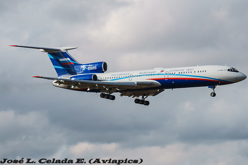
I've written a lot about the Open Skies Treaty (here), and this week the Russian Federation Open Skies Treaty certified Tu-154M is once again in the skies over the United States. There has been less media coverage this time, perhaps because the media didn't realize these flights normally happen once every month or two, and over cycled just weeks ago. In short, 34 nations are signatory to the treaty, that lets the signatories overfly each others territory, with short notice, and members of the overflown nation's military on board, to take 30cm resolution pictures of sites of interest. 30cm is the defined maximum image resolution, and was the same when the Russian's used wet film. The rest of the countries still use wet film, so far. This time, the Russians flew into Travis AFB on the West Coast, after stops for fuel in Iceland and Canada, and started observation flights Thursday March 18th 2017. The flight plan would have been tabled either late Monday or early Tuesday, and a memo to all US Military (and related to military) sites that were going to be overflown would have been sent to ensure all unicorns were in their stables, and all stolen alien technology was back underground at Area 51, or, you know, whatever.
Using its new-last-year Digital Electro Optical sensor, the flight has been basing itself out of Travis AFB in California, and at the end of the first day of observation flights, I believe it has taken pictures of the following locations, based on the altitude and airspeed. Looking at the map below, and where you see a red dot, the plane was between 290-310kn, the sweet spot to take pictures.
Friday May 19th was the 2nd day of overflights and the Russians plotted a very similar route to what they flew in September of 2016. Unfortunately, they varied their speed more than May 18th so it was a little harder to nail down exactly what they were taking pictures of. My educated guesses are below:
With two observation flights complete, the Russians flew the first leg of their trip back to Moscow on May 20th, stopping for an overnight stay in Canada at CFB Trenton, which is a treaty approved refuelling stop. All countries which are signatory to the Treaty on Open Skies must provide logistical support to Open Skies Treaty transit flights.
Here is a quick and dirty map of the locations they overflew. Why? Well, think of it this way. The sites that the RuAF are taking pictures of have been requested by the Russian Intelligence Community. Something at these sites is interesting to someone, likely in the Russian defence industry. But don't they have Google Maps? Yes, but Google Maps / Bing / Nokia are all routinely tampered with by "Agencies", and the services are happy to do so to keep on governments' good sides. Entire airports can be removed and farms photo-shopped in. Buildings are over-exposed to blot out what's on top. Facilities are entirely pixelated. Imagery is overtly tampered with, shadows moved, objects cloned. What you see on Google Maps is what the government is allowing you to see; Russia knows that. While 30cm resolution isn't the greatest commercially available, it is good enough to show tanks loaded on rail cars, new buildings that have cropped up out of nowhere, etc.. They know their camera, and the pictures it takes, have not been tampered with.
Using its new-last-year Digital Electro Optical sensor, the flight has been basing itself out of Travis AFB in California, and at the end of the first day of observation flights, I believe it has taken pictures of the following locations, based on the altitude and airspeed. Looking at the map below, and where you see a red dot, the plane was between 290-310kn, the sweet spot to take pictures.
- NAS Lemoore
- Naval Weapons Station Concord
- Military Ocean Terminal Corcord
- Naval Air Station Alameda
- CGS Oakland
- Lawrence Livermore National Laboratories
- San Jose International Airport (SJC)
- The hills east of Hollister / San Benito County, California.
- (this list is incomplete)
Friday May 19th was the 2nd day of overflights and the Russians plotted a very similar route to what they flew in September of 2016. Unfortunately, they varied their speed more than May 18th so it was a little harder to nail down exactly what they were taking pictures of. My educated guesses are below:
- Marine Corps Air Ground Combat Center Twentynine Palms
- Helendale Radar Cross Section Facility (Lockheed Martin)
- USAF Plant 42
- Edwards AFB
- Edwards AFB Aux North Site
- Tejon Ranch Radar Cross Section Facility
- NAWS China Lake
- Etcheron Valley Radar Cross-Section Measurement Facility
- Nellis AFB
- Creech AFB
- Nevada Test Site
- Beale AFB
- (this list is incomplete)
With two observation flights complete, the Russians flew the first leg of their trip back to Moscow on May 20th, stopping for an overnight stay in Canada at CFB Trenton, which is a treaty approved refuelling stop. All countries which are signatory to the Treaty on Open Skies must provide logistical support to Open Skies Treaty transit flights.
Looks like they took a gander at (now closed) Tehachapi Radar Cross Section Range facility in Antelope Valley.
ReplyDeleteThis one?
Deletehttps://www.co.kern.ca.us/planning/pdfs/eirs/PdV/Vol%20II_16%20Appendix%20F%20Northrop%20Tejon%20Ranch%20Info.pdf