Showing posts with label USAF. Show all posts

January 07, 2023

Aircraft tracking lessons from Zelenskyy's trip to Washington

The USAF have a couple of tricks up their sleeve that they can, and do, use to obfuscate aircraft movements, including VIP transport. How seldom they use these tricks to hide VIP travel would surprise you, so when they do, they're identifiable and draw attention to the aircraft. The tricks used by state aircraft to avoid observation by open source methods are not limited to the USAF and can be found being used, with varying levels of success, by other air forces worldwide.

The Trip

On December 21, 2022 Ukrainian President Volodymyr Zelenskyy flew to Washington on an American plane. The plane carrying him was distinctly operating outside the norm, providing the public with a fingerprint of what "abnormal" aircraft operations look like.

Disembarking


The aircraft shown by the press which Zelenskyy disembarked from is a USAF C-40 Clipper decorated in executive livery (an "Air Force One"-like paint job). The USAF have ~12 Clippers in different configurations, but we can identify them all. The US Navy have their own fleet of C-40 Clippers used frequently to move personnel domestically and internationally.

The USAF C-40 Clipper fleet

01-1940AE0945
01-2015AE115D
02-0201AE1165
02-0202AE1167
01-1941AE11F6
02-1942AE11F8
02-0203AE11FA
05-0730AE17EF
05-4613AE189A
05-0932AE189C
09-0540AE503D
(link)

The The USAF C-40 Clipper fleet also use ACARS; example courtesy of https://acars.adsbexchange.com


The Day Before

On the day before Zelenskyy was picked up and flown to the United States, his would-be plane took off from Joint Base Andrews, but didn't show up to open sources until they were over the Atlantic at ~02:14Z, entering British airspace, when they enabled ADS-B; USAF C-40B Clipper 01-0041 was flying as call sign SAM910, and laded at Ramstein Air Base in Germany.

Trick #1; don't fly using a transponder mode that's commonly visible to the public; from the time they departed JBA and arrived in UK airspace they likely flew using Mode-3A/3C; visible to ATC, but not commonly visible to the public. 👇


December 21, 2022

The next day the plane flew to Rzeszów-Jasionka Airport, in Poland, and apparently picked up Zelenskyy to fly him back to Joint Base Andrews. 👇


On the way back, after they passed through British airspace over the Atlantic Ocean, they reduced the amount of data being transmitted by their transponder to exclude their precise location data with ADS-B, and fell back to using simple Mode-S. 👇


Trick #2, stop transmitting precise location data when visibility isn't desired. Without precise ADS-B location data, the aircraft is only transmitting its altitude and identity using Mode-S, which would require multiple receivers to precisely geolocate using MLAT. 👇


You can see the same trick used by the RCAF when they fly operations over Iraq; they stop transmitting their precise location data and fall back to Mode-S reducing the precision with which they can be quickly geolocated.

Example: 2022-11-09 from 15:10Z to 18:22Z RCAF CC-130J Hercules 130604 flew over Iraq using Mode-S, not transmitting their precise location. 👇


Those are the two obfuscation techniques that I noticed were used and stood out to me. Looking for those tricks, they can be used as a behavioural fingerprint to identify the next VIP flight.

October 31, 2019

Do efforts to kill the Open Skies Treaty, and the al-Baghdadi raid, cross paths?

Aircrew members assigned to Russian air force Open Skies
and Airmen assigned to the 15th Wing, pose for a group photo
at Joint Base Pearl Harbor-Hickam, Hawaii, Aug. 14, 2019
Photo Credit: Tech. Sgt. Heather Redman, 15th Wing Public Affairs, USAF
There have been a series of startling things in the media which have compelled me to document and draw attention to the timing of events.
Are they related, or a coincidence?

Based on information from multiple leaks, during the 1st week of October, Tim Morrison, the National Security Council’s Russia and Europe director, put some sort of letter of intent to withdraw from the Open Skies Treaty under Donald Trump’s fingers while a pen was in them, finishing off the paperwork that John Bolton had drafted before leaving, and progressing a personal quest of Sen. Tom Cotton (R-AR) has been on for years, to kill the Open Skies Treaty. Did I mention Tim, Tom, and John are all on the same page about the Open Skies Treaty? Well, they’re three peas in a pod.
On Friday October 4th, 2019 a meeting invite went out to several departments of the United States Government for an NSC meeting on October 7th, Monday, without a set agenda.

On Saturday October 5th, Turkish President Erdogan announced an operation involving Turkish forces in Northern Syria would commence, also on Monday October 7th.

By Sunday October 6th the public was aware that the US Military would be withdrawing, leaving the Kurds to fight the Turks, and it was all defence correspondents were reporting on.

On Monday October 7th there was the aforementioned meeting between members of the NSC, and other government departments. From my understanding, all departments were told that they would have to be prepared for October 26th when they would exit the Open Skies Treaty, because Trump already signed a letter of intent to exit the treaty; which didn’t make any sense to me, since withdrawing from a treaty takes months of negotiations. I asked around if this was something about an NDAA deadline, or some other event that I was unaware of - nobody I asked knew.

On Wednesday October 9th Slate published an article giving a significant amount of detail about the story, 

Several articles were written by many experts (WSJ published one from George P. Shultz, William J. Perry and Sam Nunn), even the NYT editorial board, all in support of the treaty, and no interviews were granted to anyone at the White House or National Security Council. The leak was real, and the article by Slate was true - nobody at the NSC was ready to talk about any of it, yet.

Over the next two weeks I spent a lot of time tutoring journalists on the Open Skies Treaty, laying trails of breadcrumbs on Twitter so people could find their own information, hooking them up with experts in the field, publicising new developments about the Open Skies Treaty crisis, and tweeting background for the media and the public. All the while I was being mindful that one of the principal enemies of the treaty was at the helm, in the NSC, destroying the treaty; Tim Morrison. But what would be happening October 26th?

October 23rd, CSIS published an article on the Open Skies Treaty, and when I contacted the author for edits to the piece to make a significant detail unambiguous, he refused to make any changes - not one word - saying he stood behind every word and gave three references to other articles (including The Economist, which he may not have noticed I contributed to). Upon reviewing the articles, none supported his position.

I had contacted the author of the paper, and rethought my many objections, condensing them down to changing just one word toward the top of the article that could be changed to make it clear to the public that flights over Kaliningrad are *not* being blocked; Open Skies Treaty flights are being *frustrated*, by a 500 km limit, and the RCAF has characterised that limit as not significant to their missions over Kaliningrad.  That’s unusual, I thought, but CSIS is a think tank; there is no reason to think they would have any desire to change the piece at all. Why did they publish the piece on October 23rd, two weeks after Slate broke the story on Oct 9th? I still don’t know. That’s unusual, I thought, but CSIS is a think tank, not a newspaper; there is no reason to think they would have any desire to change the piece at all. But why did they publish the piece on October 23rd, two weeks after Slate broke the story on Oct 9th?

This is the 2nd time I’ve run into an Open Skies Treaty article related to someone at CSIS which I’ve found ambiguously worded and riddled with issues, and the author refused to make any changes then too. The last was written by Kath Hicks (and/or her research assistant), for The Cipher Brief. Not one change made out of 8 pages of feedback; I find that fascinating. Perhaps people at CSIS have been, or are being, targeted with disinformation from sources close to Cotton and Morrison; maybe John Bolton is going to appear shortly as one of their senior fellows, time will tell.

(after months of nothing in response to my email, I published the corrections publicly)

October 26th, the strike on Al-Baghdadi happened, and all leads were about the raid on Sunday, October 27th.

October 27th, the Wall Street Journal published what I would call an unusual article, it didn’t “flow” like any previous reporting about the potential Open Skies Treaty pull-out by the Americans. The article had some treaty-positive information, and also spread propaganda from the opponents of the Open Skies Treaty. I felt it missed some obvious counter-arguments about why the treaty should be kept, and it had the first quote that I’ve seen on the topic from Tim Morrison, the aforementioned NSC official who is spearheading the murder of this 34-country treaty. This was October 27th, one day after October 26th, the date given by NSC officials October 7th to be prepared for, or as we now know it, the day of the Al-Baghdadi raid. The published timeline of events so far suggests Tim Morrison would have been aware of the upcoming Al-Baghdadi raid, and I believe the leak to the WSJ was already part of the plan on October 7th. I believe it is reasonable to think Tim delayed the “leak” by “officials” to the WSJ, about their intent to kill the Open Skies Treaty until October 26th. He would be in a position to know it would take that long to get all their domestic allies on the same page, arrange information operations, get their favourite think tanks on board, “experts” lined up for interviews with the major news networks, the Al-Baghdadi raid would provide cover for the bombshell news, and would get the Open Skies Treaty announcement pushed back to a less prominent position in the daily news cycle.

  • Where does that leave CSIS and the WSJ?
  • Are they clandestinely operated by the White House?
  • Do they only publish what the National Security Council ask them to?

No, I’m not that paranoid.

I believe the answer is more human, less conspiracy. Every journalist is under deadlines, and with a limited amount of research, they need to send to press something at the end of the day, even when nobody calls them back, or maybe previous references are less than clear. Also, every journalist and researcher have their trusted sources on the topics that they’re focused on - myself included. Some of those journalists have Tim Morrison in their Rolodex (look it up kids), the guy who is actively trying to kill the treaty (and provided an exclusive quote to the WSJ), and some have John Bolton, or Sen. Tom Cotton (R-AR) as their sources; three different people, that will give them the same story, more or less. That’s all the due diligence a journalist might need, to prove they’ve researched a story, if their editor didn’t understand that those three people were the greatest threat to the treaty, and were actually the people trying to kill it. Isn’t it presumptive of me to assume they spoke to one of those three? What if they spoke to none of them? Well, those three people are very influential, themselves having contacts at right-wing think tanks, and other people around Washington, who will also parrot their talking points; they don’t live in a bubble. There is no shortage of former White House and DoD officials who have heard their anti-Open Skies Treaty talking points, and most wouldn’t know that they’re mostly trumped up (no pun intended). Sen. Tom Cotton (R-AR) and his allies have been slandering the treaty with disinformation for years, feeding half-truths to the media, committees, and the public; since Obama, at least. This faction of American government does not represent the will of the people. They represent their own interests, and should be treated as a radical, well funded, fringe group, out to endanger the world for their own reasons.


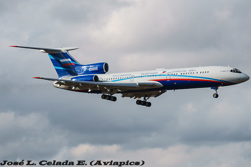
The Russian air force Open Skies Tupolev Tu-154M RF-85655,
lands at Joint Base Pearl Harbor-Hickam, Hawaii, Aug. 14, 2019
Photo Credit: Tech. Sgt. Heather Redman, 15th Wing Public Affairs, USAF

The NYT, Slate, Vox, and many others are already on record about what’s been going on with the Open Skies Treaty. Journalists have been contacting sources and writing articles since October ~8th. I can’t understand how the Wall Street Journal was able to delay by over two weeks covering the story, but I’m now watching for others who haven’t, or won’t, write about it as well because they can’t figure out what’s going on.

I hope my efforts in publicising what’s really going on disrupt any disinformation that’s being spread about the Open Skies Treaty. Any journalist with questions about the treaty or what’s been going on is free to email me questions or catch me on Twitter. I’m more than happy to brief them on the history of the treaty, give references to official documents, and referrals to more arms control academics and experts than you can shake a stick at.

Previous Important Open Skies Posts:

(also posted on Medium 2020-03-04)

February 06, 2019

2019-01-26: NORAD intercepted two RuAF long range aviation Tu-160 bombers over the Arctic.

Two Tu-160 "Blackjacks" Photo Credit: Unknown
(2019-02-08 edit added at the bottom)
On January 26th 2019 Russian Air Force Tu-160 bombers took a spin around the Arctic and drew out a welcoming party of two F-22s and two CF-188s; NORAD announced the incursion into their self-assigned "Air Defence Identification Zone" or ADIZ for short. The ADIZ is international airspace, but serves as a buffer where unidentified or suspect planes are intercepted, to make sure they don't get too close to Canada or the United States in case they have hostile intentions. While too close is subjective and the ADIZ arbitrary, potential hostile aircraft should be intercepted before they are within sovereign airspace, which only extends 12 nautical miles out to sea.

These intercepts happen routinely, anywhere from none, to fifteen times in a year
(per official NORAD numbers between 2007 and 2016 (incl.))

Here is NORAD's initial tweet from Saturday January 26th, 2019:

Subsequently, on Monday, January 28th 2019, NORAD issued this longer statement:
An E-3 Airborne Early Warning and Control System, two F-22 and two CF-18 fighter jets from the North American Aerospace Defense Command positively identified two Russian Tu-160 Blackjack strategic bombers entering the Canadian Air Defense Identification Zone on January 26, 2019.
NORAD employs a layered defense network of radars, satellites, and fighter aircraft to identify aircraft and determine the appropriate response. The identification and monitoring of aircraft entering a US or Canadian ADIZ demonstrates how NORAD executes its aerospace warning and aerospace control missions for the United States and Canada.
“NORAD’s top priority is defending Canada and the United States. Our ability to protect our nations starts with successfully detecting, tracking, and positively identifying aircraft of interest approaching U.S. and Canadian airspace,” said General Terrence J. O’Shaughnessy, the NORAD Commander. “NORAD is on alert 24 hours a day, seven days a week, 365 days a year.”
Operation NOBLE EAGLE is the name given to the military response to the terrorist attacks of September 11, 2001, and applies to all air sovereignty and air defense missions in North America. NORAD is a binational command focused on the defense of both the U.S. and Canada, the response to potential aerospace threats does not distinguish between the two nations, and draws on forces from both countries. -NORAD Public Affairs (source)

FACTS


Here is a summary of the facts, derived from the original text displayed above, which you won't see on Fox, VOA, or Axios. These are the facts conveyed by NORAD themselves. Anything beyond the above details you just read came from somewhere other than two public official NORAD statements; one Saturday (Twitter), and one Monday posted to the NORAD web site. Did the journalists speak with NORAD? Did they say so? Did they cite their source? If not, they may have made it up, or maybe their editor made it up. Call them out for it.
  • The Russian planes were in the ADIZ
  • (at least) 5 NORAD planes were involved
    • 2x USAF F-22 Raptors 
    • 2x RCAF CF-188 Hornets, and 
    • 1x E-3 Sentry (aka AWACS)
  • 2 RuAF planes were "Positively identified" by NORAD; which suggests they intercepted, then flew alongside the RuAF Tu-160s, which were always in international airspace, for a period of time, until they were satisfied they were not a threat. However, I'm extrapolating my understanding from what little they said.

To Recap:
  • 2 RuAF Tu-160s were "positively identified" in the ADIZ by 4 NORAD fighters.
That is the whole story.

SPECULATION

  • Additional USAF refuelling aircraft were likely providing gas to NORAD thirsty travellers, but that is unconfirmed. 
  • It is unlikely all four planes were escorting the Tu-160s the entire time. There would likely have been a "hand off" from one pair to the other at some point.

FALSEHOODS

  • "Russian bombers buzz North American coastline" was coined by Lucas Tomlinson (@LucasFoxNews) and Fox News producers. I can't say that a NORAD person never said those words to Lucas and his editor/producer, nor does Lucas claim they did, or quote them - someone editorialized what NORAD said. However, the statement is unlike anything I've ever heard from anyone at NORAD I've ever spoken to. "Buzzed" would imply proximity to the shore or "coast". NORAD's statement specifically said they had not entered sovereign airspace, which extends 12 Nautical Miles from shore; so factually, citing NORAD, I can tell you they were not "Buzzing" the coast, and that Fox has deliberately mis-characterized the flight for the sake of sensationalist reporting; for propaganda even.
    https://www.foxnews.com/world/russian-bombers-buzz-north-american-coastline
  • Unfortunately, other media outlets and bloggers jumped on this "coast" narrative and made it the news of the day, regardless of the facts. I hope journalists and editors realize they were used by partisan politics in propagandizing the routine flight in international airspace and will be more wary next time, but have little hope that will be the case.

RUSSIAN VS NORAD STRATEGIC COMMUNICATION:


~4 hours before NORAD tweeted about the intercept, the Russian Military TV Channel "Star" broadcast the Tu-160 story, from their point of view.

Saturday
(2019-01-26 16:48 Moscow (13:48Z)
"Два стратегических ракетоносца Ту-160 выполнили плановый полет в воздушном пространстве над нейтральными водами акваторий Северного Ледовитого океана, Баренцева, Лаптевых и Карского морей.
Продолжительность полета составила более 15 часов. В ходе полета экипажи Ту-160 отработали дозаправку топливом в воздухе."
or, Google Translated...
"Two strategic missile carriers Tu-160 performed a planned flight in airspace over the neutral waters of the Arctic Ocean, the Barents, Laptev and Kara seas.
The flight duration was more than 15 hours. During the flight, the crews of the Tu-160 worked refueling in the air."
https://tvzvezda.ru/news/forces/content/201901261648-gd93.htm

2019-01-26 19:40 Moscow (16:40Z)
"Плановый полет прошел над нейтральными водами акваторий Северного Ледовитого океана, моря Лаптевых, а также Баренцева и Карского морей."
or
"The scheduled flight took place over the neutral waters of the Arctic Ocean, Laptev Sea, and the Barents and Kara Seas."
https://tvzvezda.ru/news/forces/content/201901261936-by3o.htm

2019-01-26 12:40 EST (17:40Z) NORAD releases statement via Twitter
"An E-3 AWACS, 2x F-22, 2x CF-18 fighter jets from NORAD positively identified 2x Russian Tu-160 Blackjack strategic bombers entering the Canadian Air Defense Identification Zone on January 26, 2019. Bombers remained in international airspace and did not enter sovereign territory"

2019-01-26 23:59 Moscow (20:59Z)
«Полет был для нас более обычным и привычным. 16 часов – это не максимум, который мы летали»
or
“The flight was more ordinary and familiar to us. 16 hours is not the maximum that (we've flown)” -Lieutenant Colonel Alexander Zheludkov, RuAF
https://tvzvezda.ru/news/forces/content/201901270001-dnlk.htm

Sunday
2019-01-27 03:59 Moscow (00:59Z)
"Опубликованы кадры ночной дозаправки Ту-160 над водами Арктики"
or
"(Zvezda) Published footage (of) night refueling of the Tu-160 over the waters of the Arctic"
https://tvzvezda.ru/news/forces/content/201901270401-u447.htm

2019-01-27 04:44 Moscow (01:44Z)
"Пять военных самолетов США и Канады подняли по тревоге из-за Ту-160"
or
"Five military aircraft of the United States and Canada raised the alarm because of the Tu-160"
https://tvzvezda.ru/news/vstrane_i_mire/content/201901270444-ly6v.htm

Whereas TV Zvezda is the Russian military TV network, and usually provides original Russian-sourced information, Sputnik usually mirrors what is being broadcast in the United States with an alternative view from a Russian angle (mileage may vary); take this post which could have referred to Russian sources, but instead reported on American sources in English, and added what sort of weapons loadout they could have (not what weapons they *did* have, because all indicators point to the plane being empty).

2019-01-27 11:07 Moscow (08:07Z)
US, Canadian Jets ‘Identified’ Russian Bombers in Airspace Near Canada - NORAD
https://sputniknews.com/world/201901271071857898-us-canada-tu-160/

Monday
2019-01-28 Zulu
"An E-3 Airborne Early Warning and Control System, two F-22 and two CF-18 fighter jets from the North American Aerospace Defense Command positively identified two Russian Tu-160 Blackjack strategic bombers entering the Canadian Air Defense Identification Zone on January 26, 2019."
http://www.norad.mil/Newsroom/Press-Releases/Article/1741730/norad-identified-russian-aircraft-entering-canadian-air-defense-identification/


I think it's quite possible they intentionally schedule the flight when they expected the least response from NORAD Public Affairs and he public; my impression is these get more coverage on weekdays rather than weekends. I could be wrong.

WHAT? NO MAP?

Unfortunately, unlike the Japanese Maritime Self-Defense Forces who post a summary of Russian air movements in their air-defence zone, NORAD does not give us any context where the flights took place. This obfuscation is said to be for "Operational Security" reasons, but I don't quite understand that, since we're referring to Russian planes who know they were intercepted.

Japanese Joint Chiefs of Staff Press Release (via Twitter) including map of Russian operations near Japan; you've never seen anything like this issued by NORAD because they've never done so.


I can't see why NORAD would seem to feel releasing the above Japanese-style map would compromise national security, but it would greatly improve the understanding of NORAD operations for the public at large, and neuter any attempts at disinformation efforts that would portray the event as something more than it was.

FINE, HERE'S AN UGLY MAP

This is a screenshot of OpenStreetMaps which shows you the 12 nautical mile limit as a thin purple line. Please note that between the coast of Russia, and the line; that's Russian airspace. Between the Alaskan coast and the purple line; that's American airspace. That's all of it; 12 Nautical Miles. It's not very far at all, especially by plane.

Here we have an FAA-data driven Google Earth image showing the ADIZ. If a Russian Air Force plane flies through the green zone shown below, NORAD may send an interceptor to say Hi. They might not. The idea is to keep the Russians guessing regarding when and where they are detected by coastal radar or other national technical means. Did they, or didn't they see them flying by? You'll notice that the ADIZ is mostly over international waters, which is where you'd need to be to intercept a Russian bomber, before it unloads ALCMs at CONUS; that's the idea anyway.

Most of the time people do not see the earth from the top, and do not appreciate that Russia is just on the other side of the pole. I believe people know they are there, on the other side, but just never see what that means, like this, over the top - withe the ADIZ in green:


Exactly where the Tu-160 took off from and landed was not published, but they did say they travelled over the Arctic, Laptev, Barents, and Kara Sea - and always in international airspace; which is easy to do, since it's all international airspace past 12 nautical miles from shore.

I can hope that someone at NORAD sees my butchery of Google Earth maps / the ADIZ and demands they publish better maps so they never have to be subjected to my graphics "prowess" again.

THERE'S VIDEO?


Unfortunately Lieutenant-General Sergey Kobylash, the commander of long-range aviation of the RuAF isn't a Twitter guy, so I don't think I'll be able to ask him any specifics on the mission, but here are the videos they published of the flight (the same flight) as NORAD announced. You may not be aware, but NORAD has no obligation to Canadians or Americans to tell us every time they perform one of these interceptions; they only release the information if the Russians publish something about it, or if someone at the Pentagon leaks it to the press, forcing their hand.

As an aside; it sure would be nice to get 1080p or 4k NORAD footage, wouldn't it?


The news media routinely make the same mistakes, with clickbait headlines about intrusions into North American airspace, every single time one of these flights takes place, but NORAD every single time diligently tells the public no national airspace was crossed, and the bombers were never in sovereign airspace. Why editors and producers of the news ignore this can only be because of clicks, because it certainly isn't from being accurate. Kudos to you journalists who didn't fall for the "buzz the coast" narrative, and a finger wag to those of who who spread the story in that "Fake News" light.

2019-02-08 Update


Thank you to the mystery person (and people!) who are monitoring the Russian HF radio networks the bombers talk to each other (unencrypted, old school, voice comms) while performing operations, live tweeting it for the world to read as it happens. I completely missed this thread on Twitter, and several side-bar threads of people I follow, and who follow me on Twitter; so I profusely apologize to them for not noticing and not including the information they had put out there while the action was going on.


We knew the Russians said they were doing refuelling up over the Arctic on their 15 hour training flight, but now we know the composition of that effort.
  • 2x Tupolev Tu-160 strategic bombers (58401, 58402)
  • 1x Tu-160 strategic bombers acting as a communication relay (58403)
  • 4x Ilyushin Il-78 refuelling planes (90722, 90723, 90724, 90725)
That's a pretty impressive sortie, I'd say.

October 03, 2017

Open Skies Treaty overflight of the United States by the RuAF Sept 25-29 2017

From September 25th to 29th the USAF played host to an Open Skies Treaty overflight of the United States by the Russian Federation.  Here is the flight plan as captured by FlightRadar24, as best as it was able to track the flight using Mode-S MLAT, triangulating transponder information received by private receivers across the country. You'll notice the green dots are likely sites which pictures were being taken, as they were within the allowable envelope. Provided they were at ~11,000ft, and not banking, they would be allowed take pictures, per the treaty and arranged flight plan.

Flying at 11,000ft indicates the digital electro-optical sensor (that when spoken of before the Senate Armed Services Committee was made to sound like the Death Star by DIA 3-Star General Stewart) was in "medium" altitude mode, and the swath was 7.7km (4.8mi) total width.  Please remember that USAF members are aboard the plane for the entire overflight, the camera being used has been certified by a 22 nation committee, and the resolution of the imagery is worse than commercially available satellite imagery.

As usual, the USAF did not inform the American people of this overflight because their media posture is "passive", by policy. Only the Russian news media, usually maligned as "fake news" or propagandists, inform us of these flights. Why would the US Government be more controlling with the message than the Russians? Wouldn't they want to show a working treaty in action and dispel any fear about the Red Scare narrative? 🤔

(There is another Open Skies overflight going on this week, FYI)

August 19, 2017

Russian Open Skies Treaty overflight of the USA, August 2017 edition

Refer to previous posts I've written on the Open Skies Treaty for background; this post is just to get you the map with all the flight information available from FlightRadar24.

While elements of the media have been focused on the "outrage" of the "low-level" flight over the Pentagon, Camp David, and Trump's golf course, I've been laughing at the other obvious targets of their photography; including one of my favourite military targets; Site R.  Several military bases, Navy facilities, Shipyards, Ammunition Depots, etc.. were photographed as well.  Their altitude (~4000ft) suggests a digital panoramic camera is being used, but I don't have confirmation of that. The treaty mandates a maximum of 30cm resolution, which is less detailed than commercial satellite imagery, but the camera is certified as being tamper-proof, and the imagery can (is) shared among all 34+ signatories of the treaty.

Anyone telling you the Russians are using the Open Skies Treaty for purposes it wasn't intended to be used for has not read the treaty, or has ulterior motives.  Don't believe the hype, look for yourself.  Zoom in on the map below, look up your favourite East Coast military facilities.  A reminder tho; military targets are not always military buildings or property.  Tanks could be sitting in a rail yard, and could be just as valuable to check out year to year. General Dynamics or other defense contractors might be performing tests at a civilian owned property.  Some very poorly informed people have even suggested the treaty has something to do with missiles. It does not. The treaty covers everything and anything they want it to cover; and that's how it works for our overflights of Russia as well.

Unfortunately, the "new" low altitude (by comparison w/ former ~10,000ft) flights makes it hard to triangulate the transponder using MLAT, so the flight route is spotty.  Many of the targets are quite obvious.  Also of note, the "swath" that the camera catches in the frame is large; I'm not sure how large with that camera at 4,000ft, but they do not need to be "over" something to get a good picture of it.


August 17, 2017

Two Russian Open Skies Treaty aerial observation missions over the USA in June 2017

If you're unfamiliar with the Open Skies Treaty, I've written quite a bit about it before, and I highly recommend leafing through the old blog posts to get up to speed.

What you're about to read is coverage that no news organisation (that I'm aware of) is providing you, because USAF policy is to not talk about Open Skies Treaty observation flights.  Yes, like Fight Club. Since no press releases are put out by the USAF, no US media cover the flights, because they don't know what to say, and all the USAF personnel who could say something, are not allowed to per USAF policy.  Page 30, Section 4.2.1.1.4.7, Air Force Manual 16-604 (2009) "posture for OST flights is “passive.” (we) respond to inquiries, but (don't) promote activities" while that does not specifically state that USAF personnel are not allowed to talk about it, the information is classified (a low-level classification) and the treaty is obscure.  If the US Media were trying to confirm when a flight was happening, IF it was happening, their first source would be TASS or Sputnik, which would immediately raise red flags to Western Media editors. After all, why believe these agents of disinformation and Russian propaganda?  Well, maybe because they're the only people who publicise the treaty overflights; of the US over Russia, or Russia over other countries.  Why is it that only Russia tells their people about a 34+ nation treaty that's working extremely well? Why doesn't the US government want their citizens to know they exercise their treaty rights to overfly Russia, and Russia does the same to the USA, on an almost monthly basis?

I don't know. It's a complete mystery to me.

The Russian Federation performed two scheduled aerial observation missions over the United States under the terms agreed upon by the 34-35 nations in the Treaty on Open Skies, or Open Skies Treaty as it is commonly referred to, between June 19th and June 30th, 2017. Per treaty rules, they left, stopped at CFB Trenton, and went back in between overflights.

June 19 - June 23, 2017

The Russian team flew in to Travis AFB, on their Treaty-approved Tupolev Tu-154M, and recently outfitted digital camera, from Moscow, on Monday, and likely negotiated the flight plan they proposed on Tuesday morning with the American team. The US team is assigned to escort them in their observation plane and ensure all restrictions of the overflight are adhered to; heights are as promised, courses are adhered to, etc. From Tuesday to Thursday (Thursday is when the observation flights started) the US military and defence industry would have been alerted, and would likely have been covering up/moving any equipment they did not want photographed that was along the flight path.  This is standard procedure, and known to be a cat and mouse game.  Anything too big to move will simply be photographed, but these flights, while short notice, can be anticipated to a certain extent. They are routine, happen half a dozen times a year, and I don't think any out-in-the-open testing is ever performed without consideration regarding it being photographed by satellites or the Open Skies Treaty overflights.  After all, the Russian Federation (and the Chinese) also have satellites which can (at least) see the visual spectrum, and may also be outfitted with space-borne Synthetic Aperture Radar. After a brief tour of California, the Russian team (with their American handlers aboard) went to Alaska.  Unfortunately, FlightRadar24 and ADSBExchange have terrible coverage up there, and little of the flight was captured by transponder.  From what I gather that may or may not have overflown several air force bases including missile launch facilities.


June 26 - June 30, 2017

The second week's flights took place first over Texas at a low altitude (5000ft), then after a brief stop to uncover the belly mounted framing camera, continued at a higher altitude. On Friday they finished off the New Mexico leg of the trip, overflying many famous historical nuclear test, development, and production facilities.


But what did they take pictures of?  Well, that's an excellent question. I don't know, but I can make some educated guesses, and you can too,  if you follow along:

  • Open Skies Treaty flights are based on a negotiation of a flight plan that is proposed by the overflying party. The observed party can argue or debate which route to the locations might be best, if poor weather is expected, or if cloud cover will hamper the trip, they can propose alternate routes or sites. Ultimately, the overflying party can refuse the options and insist on the flight plan they want, and if the overflown party objects, they need to cancel the whole trip, with causses a major international incident.  But, there are some things that are constant on these flight plans (from studying past flight plans); steady speed and constant height are tell-tale signs of photos being taken. When the flight plan is agreed to, there are legs, and for each leg an altitude is selected which will place the camera at the correct distance from the ground to get 30cm imagery.  Same with speed; they want the speed of the aircraft to be consistant. Usually the height is between 8000-12000ft and the speed between 300-350kts.  On the maps I've marked potential sites in the right speed envelope in green (based on my best estimate). If the plane is doing 500kts, they aren't taking pictures. If they're at 34,000ft, they aren't taking pictures either. If they're at 8,000ft, and doing 300kts, you can bet they're taking pictures, or are lining up for the shot.
  • American military or defence installations are sometimes pretty easy to spot along the line, especially if they're extremely remote.  If in the middle of a desert there's a runway, some fiel tanks, and some buildings... congratulations you've found some semi-secret remote military industrial complex test site, or where they keep the aliens; you get the idea.  If the speed of the plane is between 300-350, and the height is stable, that's the sweet spot, and you know there is either something there, something was there previously, or they thought something could be there, and wanted a closer look.
  • Open Street Maps makes it easy to spot government facilities, as they're usually large pink sections of the map. Have a look at https://www.openstreetmap.org/ if you're struggling to name a site, and you might find it spelled out to you.
This is an Open Skies (OS) Format 14 document, submitted to the Canadian RCAF by the Russian RuAF at the conclusion of one of their Open Skies Treaty flights over Canada.


As I've pointed out previously, there is absolutely no reason any American reading this couldn't request (via FOIA) from the USAF, State Department, or DTRA, ALL the flight plans documented on Open Skies Format 14 templates (like the above) from 2002 to present day.
That will tell you exactly what legs were flown, and where the pictures were taken.

So what are you waiting for?

May 19, 2017

Russian Observation flights over the United States, again. (May 18-19 2017)

T-154M-LK1 RF-85655
I've written a lot about the Open Skies Treaty (here), and this week the Russian Federation Open Skies Treaty certified Tu-154M is once again in the skies over the United States.  There has been less media coverage this time, perhaps because the media didn't realize these flights normally happen once every month or two, and over cycled just weeks ago.  In short, 34 nations are signatory to the treaty, that lets the signatories overfly each others territory, with short notice, and members of the overflown nation's military on board, to take 30cm resolution pictures of sites of interest.  30cm is the defined maximum image resolution, and was the same when the Russian's used wet film.  The rest of the countries still use wet film, so far. This time, the Russians flew into Travis AFB on the West Coast, after stops for fuel in Iceland and Canada, and started observation flights Thursday March 18th 2017.  The flight plan would have been tabled either late Monday or early Tuesday, and a memo to all US Military (and related to military) sites that were going to be overflown would have been sent to ensure all unicorns were in their stables, and all stolen alien technology was back underground at Area 51, or, you know, whatever.

Here is a quick and dirty map of the locations they overflew. Why? Well, think of it this way. The sites that the RuAF are taking pictures of have been requested by the Russian Intelligence Community.  Something at these sites is interesting to someone, likely in the Russian defence industry.  But don't they have Google Maps?  Yes, but Google Maps / Bing / Nokia are all routinely tampered with by "Agencies", and the services are happy to do so to keep on governments' good sides. Entire airports can be removed and farms photo-shopped in. Buildings are over-exposed to blot out what's on top. Facilities are entirely pixelated.  Imagery is overtly tampered with, shadows moved, objects cloned. What you see on Google Maps is what the government is allowing you to see; Russia knows that.  While 30cm resolution isn't the greatest commercially available, it is good enough to show tanks loaded on rail cars, new buildings that have cropped up out of nowhere, etc.. They know their camera, and the pictures it takes, have not been tampered with.

Using its new-last-year Digital Electro Optical sensor, the flight has been basing itself out of Travis AFB in California, and at the end of the first day of observation flights, I believe it has taken pictures of the following locations, based on the altitude and airspeed.  Looking at the map below, and where you see a red dot, the plane was between 290-310kn, the sweet spot to take pictures.


Friday May 19th was the 2nd day of overflights and the Russians plotted a very similar route to what they flew in September of 2016.  Unfortunately, they varied their speed more than May 18th so it was a little harder to nail down exactly what they were taking pictures of.  My educated guesses are below:


With two observation flights complete, the Russians flew the first leg of their trip back to Moscow on May 20th, stopping for an overnight stay in Canada at CFB Trenton, which is a treaty approved refuelling stop.  All countries which are signatory to the Treaty on Open Skies must provide logistical support to Open Skies Treaty transit flights.

Russian Open Skies Observation Mission Over USA (April 13-14 2017)

April 13-14th 2017 the Russian Federation conducted an overflight of the United States in compliance with the Open Skies Treaty, with members of the USAF on board.

You will notice the sites along the Eastern Seaboard are all at locations where the Russian Navy AGI Viktor Leonov AGI spotted in February and March.  Coincidence? Absolutely not.  The Viktor Leonov's mission is to profile subs, investigate coastal radar, sonar, subsurface sensors, etc. The Open Skies Observation flight was more than likely to check out the same sites it was performing ELINT on, to "see" from above the interesting things it picked up while it was at least 12 nautical miles from shore.


October 01, 2016

Russian Open Skies Treaty overflight of the USA | September 26th-30th 2016

Nevada Test Site - Gate 1
Taken April 2 2010 - Photo by Bill Ebbesen (Wikipedia)
While I don't intend to blog about every single Open Skies Treaty overflight of the United States of America by the Russian Air Force, Nevada is a hub of historically significant military sites, and continues to be a hotbed of military testing facilities, restricted airspace, and military bases. Generally, the Russian Air Force doesn't pick the places they photograph; they are the operators and tip of the spear;.  The RuAF execute requests by other agencies for imagery of American locations of interest, not just requests from the Russian Ministry of Defence. Since each Open Skies mission has a limited amount of distance it can cover, as mandated by the Treaty, the Russians do not try and fly over all of the US at once, they break it up into zones. This flight was an observation mission over California and Nevada. If you zoom in to a reasonable detail level and follow the flight path you'll find a "who's who" (a what's what?) of DoD and DoE locations, as well as other places of interest to the Russian Federation.  Reverse-engineering this flight path, you can discern where the US Military is conducting their most sensitive testing, training, research, and any number of other "interesting" things.

Previous Open Skies treaty posts here for background.

Thank you @ktul_adsb for spotting additional points of interest!

NB: RF-85655 just took off en route to CFB Trenton, Iceland, and ultimately Kubinka (Кубинка) Air Base, originating from Travis AFB where last week's mission was being based from.


September 17, 2016

Tracking American Open Skies OC-135B/W Aircraft

"An OC-135B aircraft sits on an airfield at Ulan-Ude, Russia prior to an Open Skies flight.
DTRA conducts inspection flights with the U.S. Air Force in accordance with the Open Skies treaty."
(DTRA photo - March 3, 2009) Flickr
The United States operates two Open Skies Treaty-approved planes designed to perform observation missions over Russia, or other countries.  The aircraft are based out of Offutt AFB for ops, training and maintenance, and function as part of the 55th Wing, 45th Reconnaissance Squadron (per Wikipedia).

The United States Air Force does not publish press releases, or mention to the media, when they perform Open Skies Treaty overflights; to keep track of the flights using OSINT, adsbexchange.com and flightradar24.com can be leveraged.  

Using Google, the tail numbers became clear  (Registration / ICAO):

Boeing OC-135B Open Skies (61-2670 / AE08D5)
Boeing OC-135W Open Skies (61-2672 / AE08D6)

While the transponder beaconing from 61-2670 broadcasts that it is a Boeing OC-135B, 61-2672 reports itself as an OC-135W.  Contradictory information online suggests both planes are of the OC-135W variety, but I can't find the differences between one and the other.  It could be a cosmetic difference, I'm unclear what the difference in designation would be between the OC-135B and OC-135W.  Regardless, if you sign up for an account on FlightRadar24.com you can program an alert to be emailed to you when the flights are detected by one of their global network of receivers.

If you want to look at historical flight information, adsbechange.com may be more useful for that task (and free!).

Here is a direct link to a dynamic report containing the most recent OC-135B/W flights (it takes a while to load, hang tight)


Callsigns

There is some confusion about the callsigns that are used, and it comes from the historical report mentioned above.  It seems that when an Open Skies overflight mission is underway, the callsign used, for either airframe, is OSY12F (does F stand for overFlight?), and when the plane is in transit the callsign is OSY12T (does this indicate "in Transit"?).  

The two planes also use other callsigns; and I'm not sure what they are otherwise commonly used for, if they are indicative of any specific operations that are not Open Skies related.  

From October 13th 2015 and September 17th 2016 I noticed the following callsigns being used by 61-2670 and 61-2672, as documented on adsbexchange.com
COBRA12
COBRA23
COBRA24
COBRA32
COBRA35
COBRA43
COBRA44
COBRA45
COBRA46
COBRA52
COBRA53
COBRA55
COBRA70
COBRA72
SABRE35
TORA82
TRUBS72
...suggestions as to what operations these callsigns might be indicative of, or confirmation they mean nothing at all, would be welcome!  ( Some callsigns have been noted previously from 55 Wing / 45 Recon here and here, but do not indicate if they suggest a specific function (training/deployed ops/etc) )

August 19, 2016

Are American B-61 Nukes moving from Incirlik Turkey to Deveselu Romania?

On Thursday morning a friend of mine tipped me off to a story I hadn't seen yet in the news; reportedly the Americans were moving their B-61 tactical nuclear bombs from Incirlik Turkey to
Deveselu Romania due to unrest in Turkey.  Without knowing any more facts about this story, it is absolutely ridiculous for several reasons which I will explain, and unlike the "anonymous sources" that were originally quoted as saying the move was taking place, I will explain to you why it is laughable and appalling journalism to report and amplify this blatant fabrication.

Who the hell are you? Why should I trust you over a news outlet?

Good question.  I'm the guy who for the past 4 years has been researching Cold War era nuclear weapons storage facilities, and conventional ammunition storage facilities, in Canada.  Unrelated?  Well, things really haven't changed much.  Some of the weapons delivery systems are even the same.  Interestingly, my research has also brought me to information about weapons storage facilities internationally, since the United States built all of their nuclear weapons storage facilities to the same specifications, improving them incrementally over the years, but keeping to some basic tenants.  Do I have a PhD in Nuclear Non-Proliferation Treaties? ...Architecture of Weapons Storage Areas?  ...History of Nuclear Weapons? No. I'm just a guy with a history hobby who gets really pissed off when the public is taken for a bunch of idiots by wild lies which can be disproven if you're familiar with the topic.

1) American policy has been, and continues to be, to not confirm or deny where their nuclear weapons are stored, which is coy, but not useful when you're trying to figure out the historical record.  Therefore, any news outlet which reports they have contacted the US Government, Department of Defence, or Department of State, or whoever, and have received to response or confirmation to the presence or movements of nuclear weapons should not frame this in a suspicious manner or make it seem like an admission of guilt.  They never say where any nuclear weapons are stored, ever.  They're not starting now; it's not suspicious.

2) American standards for physical security at locations where nuclear weapons are stored are the highest of any facility anywhere.  Building standards for weapons storage areas show the fences are higher and cemented into the ground, so you can't dig under them.  There are multiple fences, with barbed wire, and a defoliated area around the storage area, so the guard towers, armed with machine guns, can take out any potential threats.  Recently, B61 nuclear weapons specifically, are stored in underground vaults that pop up inside hardened airplane hangers designed specifically for F-15E Strike Eagles, F-16s, or other European allied aircraft capable of being used as nuclear weapon delivery vehicles.  The American military takes their custodial duties of their state's nuclear weapons very seriously.

In 2005 the following locations had facilities capable of storing B-61 nuclear weapons to the physical security standards required:
- Kleine Brogel AB, Belgium
- Büchel AB, Germany
- Nörvenich AB, Germany
- Ramstein AB, Germany
- Araxos AB, Greece
- Aviano AB, Italy
- Ghedi Torre AB, Italy
- Volkel AB, Netherlands
- Akinci AB, Turkey
- Balikesir AB, Turkey
- Incirlik AB, Turkey
- RAF Lakenheath, United Kingdom
There is no reason for the American military to take 50 B-61 tactical nuclear weapons to Romania, when there are several other bases in Europe which do have the proper physical security, and some already have nuclear weapons in storage.

3) Nuclear agreements must be in place at a political level for the storage of those weapons in other countries; in 2005 the nations with which the US had agreements were
- Belgium
- Germany
- Italy
- Netherlands
- Turkey
- United Kingdom
   (NB: not Greece)

(source: https://www.nrdc.org/sites/default/files/euro.pdf)

4) It isn't just physical security; a Munitions Support Squadron would need to be present in Deveselu Romania to handle the weapons, which is not the case.

5) They're gravity-bombs, Deveselu Air Base no longer has a full runway (not sure how many feet are left); the ballistic missile defence facility is built on top of part of it.

6) Additionally, how would the B-61s be transported there?  Normally the Americans do not ship nuclear weapons by ground, they are flown in by heavy transport (C-5/C-17); but without an air strip capable of handling those planes, no such transit would be possible. @natehale notes that McChord AFB has the only nuclear airlift unit capable of moving the B-61 nuclear weapons from Incirlik, and there have been no reports of any movements of heavy transport from McChord.  Plane-spotters are very diligent; someone would have seen something.

But hey, don't believe me; follow the foremost the experts in the field and make up your own mind.

Hans Kristensen (@nukestrat) is the Director of the Federation of American Scientists Nuclear Information Project, and foremost expert in this field globally.

Jeffrey Lewis (@ArmsControlWonk jlewis@miis.edu) is the Director of the East Asia Nonproliferation Program, at the Middlebury Institute of International Studies and columnist for Foreign Policy Magazine.

Late breaking, Georgi Gotev (@GeorgiGotev) the Senior Editor of the original news outlet to run with this story explains his decision to run with the fake news here.  Thanks.  Your ignorance on the topic clearly absolves you of any fault in being party of distributing misinformation from the Russian media propaganda machine.  You were targeted by Russian intelligence to distribute this story, that paints Romania in a poor light, and furthers the Russian narrative that Romania is a threat to Russia.  First the ballistic missile shield facility, now nukes? This paints the picture that Romania is the enemy and will be a target of future Russian aggression.  Well done.

July 05, 2016

Why are the Russians intercepting USAF planes over International Waters?

Boeing RC-135W Rivet Joint - 62-4131 (same as was intercepted)
Photo taken: October 25, 2015 - Mildenhall Air Force Base
Photo Credit: Simon Mortimer / JetPhotos.net
Blair Gertz's article on aggressive Russian posturing should make people wonder, what the hell are they doing?  There has been little (no) editorials written (that I've seen) about what would make Russia harass the US Air Force or US Navy in or above international waters.  Where are "International Waters" anyway?
"Territorial waters, or a territorial sea, as defined by the 1982 United Nations Convention on the Law of the Sea, is a belt of coastal waters extending at most 12 nautical miles (22.2 km; 13.8 mi) from the baseline (usually the mean low-water mark) of a coastal state." -Wikipedia
On April 14th 2016 an RC-135W, call sign HOWL77, registration 62-4131, (reportedly) had its transponder on, and was met by at least one Su-27 over the Baltic Sea.  I presume the plane was near, and clearly targeting, Kaliningrad Oblast with it's sensor suite, or was on a flight path that made the Russian expect they would be.  After all, why else would you fly a spy plane in the Baltic?  As a reaction, the RuAF sent a fighter or two to intercept and shoo away the Americans.

Kaliningrad Oblast, is part of Russia, although it does not have a land bridge to Russia.  Kaliningrad Oblast extends about 250 km inland; I've marked 22 km on the map below so the distance can be appreciated.  That doesn't look very far, because it's not.


Consider this; due to the curvature of the earth, the higher up you are, the farther you can see before the horizon limits your view.  If you had a 100 Meter tower, you'd be able to see ~35 km from the top of that tower to the horizon.  If you had two 100 Meter towers, you could see between the tops of the towers ~70 km away from each other.  This is how terrestrial microwave repeaters work; you take two towers, put directional antennas (dishes) on them that point at each other, and you can beam a signal ~70km away.  If you keep putting towers up in a line, you get a trans-continental microwave network like the one built across Canada in 1959... but that's another topic.

So what are the planes the US are flying in "International Waters"?  The RC-135, part of the 95th Reconnaissance Squadron flying out of RAF Mildenhall, England, has been hitting the news, but I wonder if the E-8C JSTARS flying out of  Geilenkirchen NATO Air Force Base in Germany are also flying around.
"The RC-135 Rivet Joint is an Electronic Intelligence (ELINT) collecting reconnaissance aircraft that has the ability to detect, locate and identify emitting mobile targets with its Automatic Emitter Location System (AELS)" - US Air Force School of Advanced Airpower Studies (link)
"The E-8C JSTARS aircraft is a battle surveillance platform that employs its on-board AN/APY-3 system to detect and track mobile ground forces. The AN/APY-3 is a SideLooking Airborne Radar (SLAR) that incorporates SAR and MTI capabilities. Its MTI/Wide Area Surveillance (WAS) capability detects, locates, and classifies slow moving vehicles. The MTI technique that is used allows differentiation between wheeled and tracked vehicles. The MTI/Sector Search (SS) mode provides enhanced image resolution and attack guidance. Other operating modes may include an enhanced SAR for ‘super’ resolution imagery and an inverse SAR for target recognition" - US Air Force School of Advanced Airpower Studies (link)
Both of these quotes are from the year 2000; it's hard to find information on reconnaissance aircraft for some reason.

The RC-135 has a ceiling of 50,000 ft according to the US Air Force.  Even at 40,000 ft, the horizon would be 715 km away; making Kaliningrad Oblast, all of it, in full view if you looked out the window of the plane.  Back in the Cold War, the U2 spy plane flew over Russia with downward facing wet film cameras; that was the technology of the time.  The U2 was also famously shot down over the Soviet Union in 1960; it was clearly in the Soviet's right to do so, as it was over their territory.  But what if you flew high, and angled the camera diagonally, staying over international waters?  You could achieve almost the same effect, but get better resolution than a satellite flying high over the objective, without the distortion of the atmosphere, and with the moral high ground that you're not flying over the sovereign territory of the country you're spying on; you're over "international waters".

In 1991 during the Gulf War, the E-8C's AN/APY-7 radar could track 600 targets and cover 50,000 km2, at a range of 250 km in a 120 degree field of view.  I'm going to guess they've improved the technology since 1991, so consider that the worst it could do. (data based on "Activity-Based Intelligence: Principles and Applications" by Patrick Biltgen, Stephen Ryan)  The capabilities of the system continue to improve.

The RC-135 is a SIGINT/ELINT platform fitted with all sorts of antennas to be able to listen to, and tell what direction any electronic emission is coming from.  Listening to everything transmitting wirelessly in all of Kaliningrad would be the objective of flying near Kaliningrad, I'd think.  As a reconnaissance aircraft that's spying (diagonally) at their territory, I'm not very surprised the Russian Air Force is playing mind games with the US Air Force and "buzzing" them with fighter jets.

How about the Russians?  Aren't they flying near the US with their bombers and long range reconnaissance planes?

Why yes they are, once or twice a month, but the closest they've come in decades is 39 miles from the California coast, on July 4th 2015, off the coast of California, over International Waters (there's that term again...).

"two U.S. F-15 jets intercepted the Russian bombers on July 4 as they flew as close as 39 miles from the coast of Mendocino County, north of San Francisco." -Blair Gertz, Washington Free Beacon

39mi is 63km, which is almost three times farther as the RC-135 was from Kaliningrad in April.

Why is it when empty Russian bombers are antagonizing the Americans off the coast it's war games, and when the US is antagonizing the Russians off their coast with bleeding edge spy planes, listening to, and exploiting emissions, it's just a little good fun?

The language of the outrage used in US vs Russian press releases, and biased news reports, needs to be critically studied constantly in order to see through the spin.